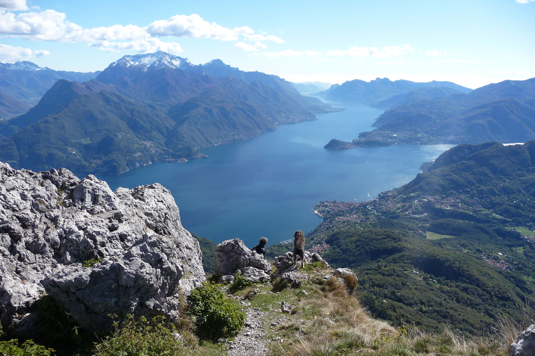
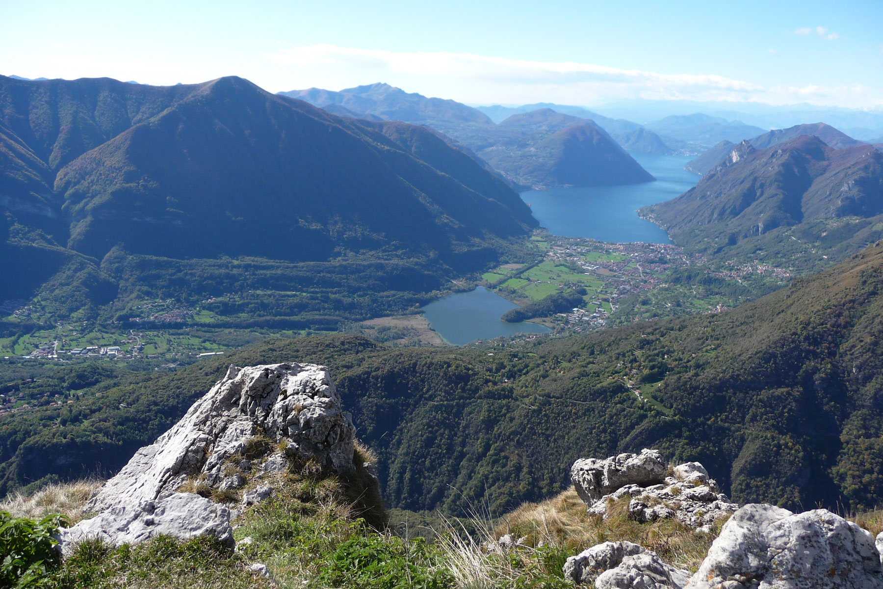
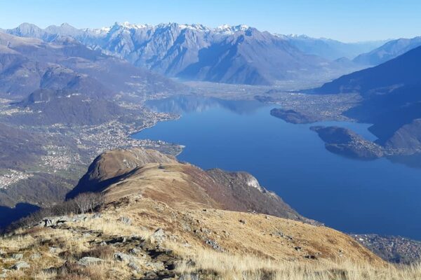
From the top of Monte Grona (1736 m) one can admire one of the best views of the Prealps; apart from the three lakes (Como, Lugano and Piano) you can also see the close by peaks of Monte Bregagno, Legnone, Pizzo di Gino, Grigne and if the day is clear enough, many peaks of the Alps from Monviso to Bernina. The trails leading to the top of Monte Grona start from Rifugio Menaggio.
Description
Route: from the bus stop at Breglia (749 m) cross the road and ascend the small carriage road leading up to Monti di Breglia (sign post indicating Rifugio Menaggio) and, after the washhouse, you take the first shortcut on the right that leads to the road that leads up to Monti di Breglia. Cross it and take a dirt road. After a 20 meters, at the fork, go up to the right.
Back on the carriage road, follow it for about a hundred meters and then cross a meadow on the left. After crossing the road again, follow the path that leads to Monti di Breglia (996 m). Here there is a picnic area with a fountain and a beautiful view of the lake.
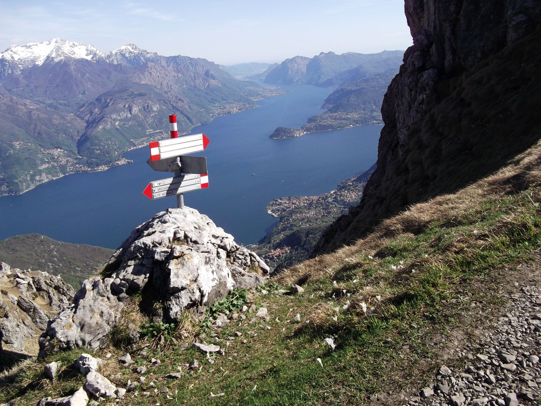
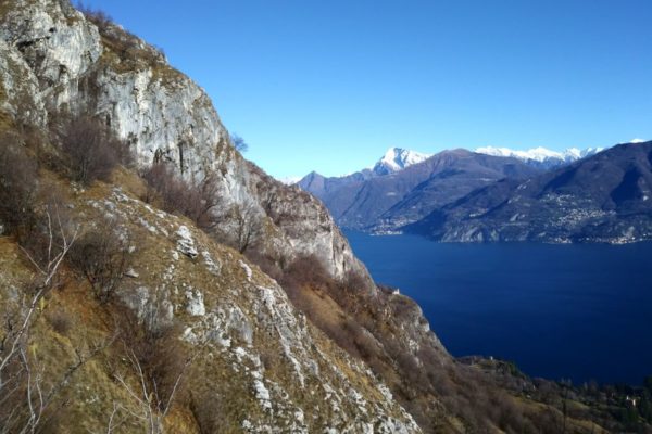
Here you leave the road and follow the trail over some rocks up to the left (sign). You reach the parking area of Monti di Breglia which you cross and then pick up the trail to the left. At the fork take to the right (in winter, in case of heavy snowfall, the one on the left is recommended) that leads among birch trees and broom up to the fork S. Amate / Monte Bregagno / Rifugio Menaggio. At this fork turn left direction rifugio Menaggio. The now quite level trail leads along the slope of the mountain to rifugio Menaggio. The view embraces the whole central lake area with the towns of Menaggio with Monte Crocione (alt. 1640 m ), Bellagio with Monte San Primo (1682 m) and the Corni di Canzo (the two horns of Canzo) and Varenna dominated by the Grigne (alt 2410 m)
From the Rifugio Menaggio you can reach the top of Monte Grona via two different routes, which have the same difference in height (349 m) but different times and difficulties. There is also a third way to reach the summit, which follows the Via Ferrata del Centenario, however, it is reserved for expert mountain climbers with adequate equipment.
- Via Normale (about 1h 15min)
Take the trail that begins behind the refuge, follow the signs for “Via Normale” until you reach the fork S. Amate-Monte Grona, continue along the path on the left that climbs up to Forcoletta (1627 m). From here, turn left and climb up a very steep and exposed ridge. After a short time, you will reach the summit of Monte Grona, assisted by a cable to overcome the final climb. - Via Direttissima (about 1h)
This path is steeper and more exposed than the Via Normale. Also this path starts behind the refuge, but you follow the signs for Via Ferrata. After a short time, you arrive at a small saddle, turn right and follow the signs Via Direttissima and climb up the steep south gully. At the end of the gully, turn left. After a short time, you will reach the summit of Monte Grona, assisted by a cable to complete the final climb. - Via ferrata – only for Alpinists with adequate equipment, time: 2.30 hrs. In order to reach the beginning of the Via Ferrata you follow part of the Via Panoramica.
Note: – Rifugio Menaggio (1400 m) – Loc. Mason del Fedel
Tel. +39 0344 1930017 or +39 375 5108734 – www.rifugiomenaggio.eu – Open every day from the end of May to the end of September, from October to May open every weekend and public holiday, on request
Directions & Parking
Parking
Free parking at Breglia in Via a Carcente
Parking at Monte di Breglia – pay fee (3 euro in coins) at the automatic ticket machine at the beginning of the road leading from Breglia to Monti di Breglia
By public transport
From Menaggio you can reach Breglia by bus in 25 minutes with bus line C13.
Gallery