[Skip to main content]
hike to alpine mountain lake Lago Darengo

Lake Darengo

Hikes

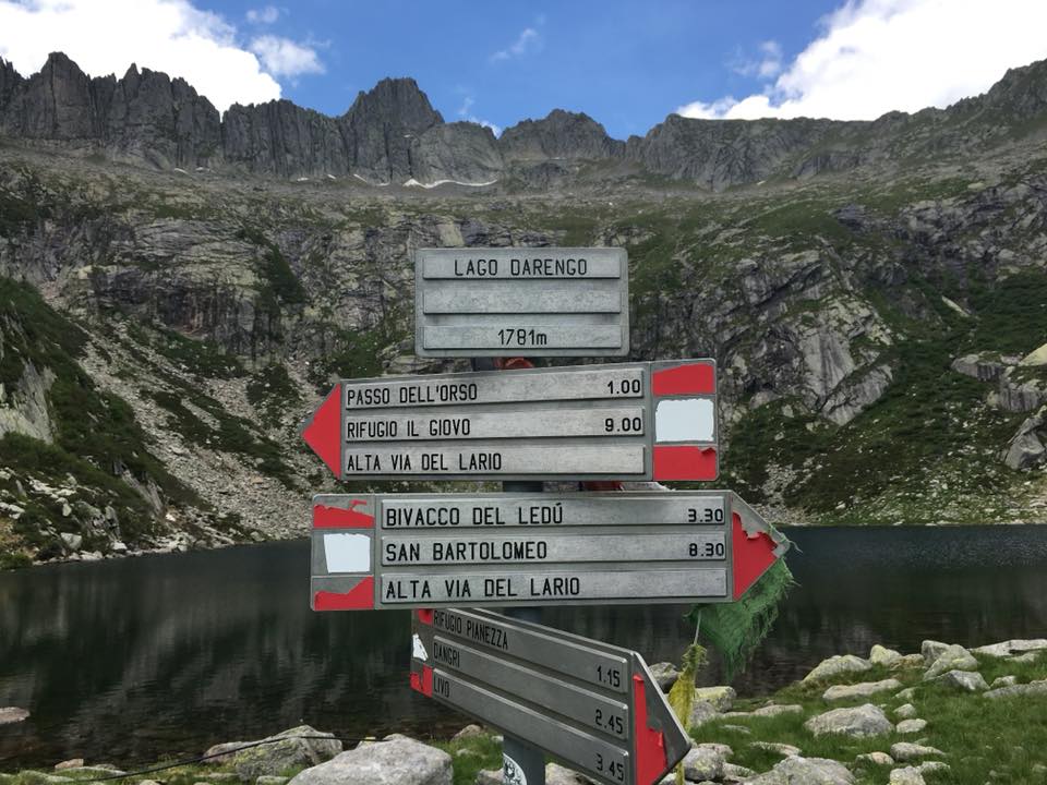
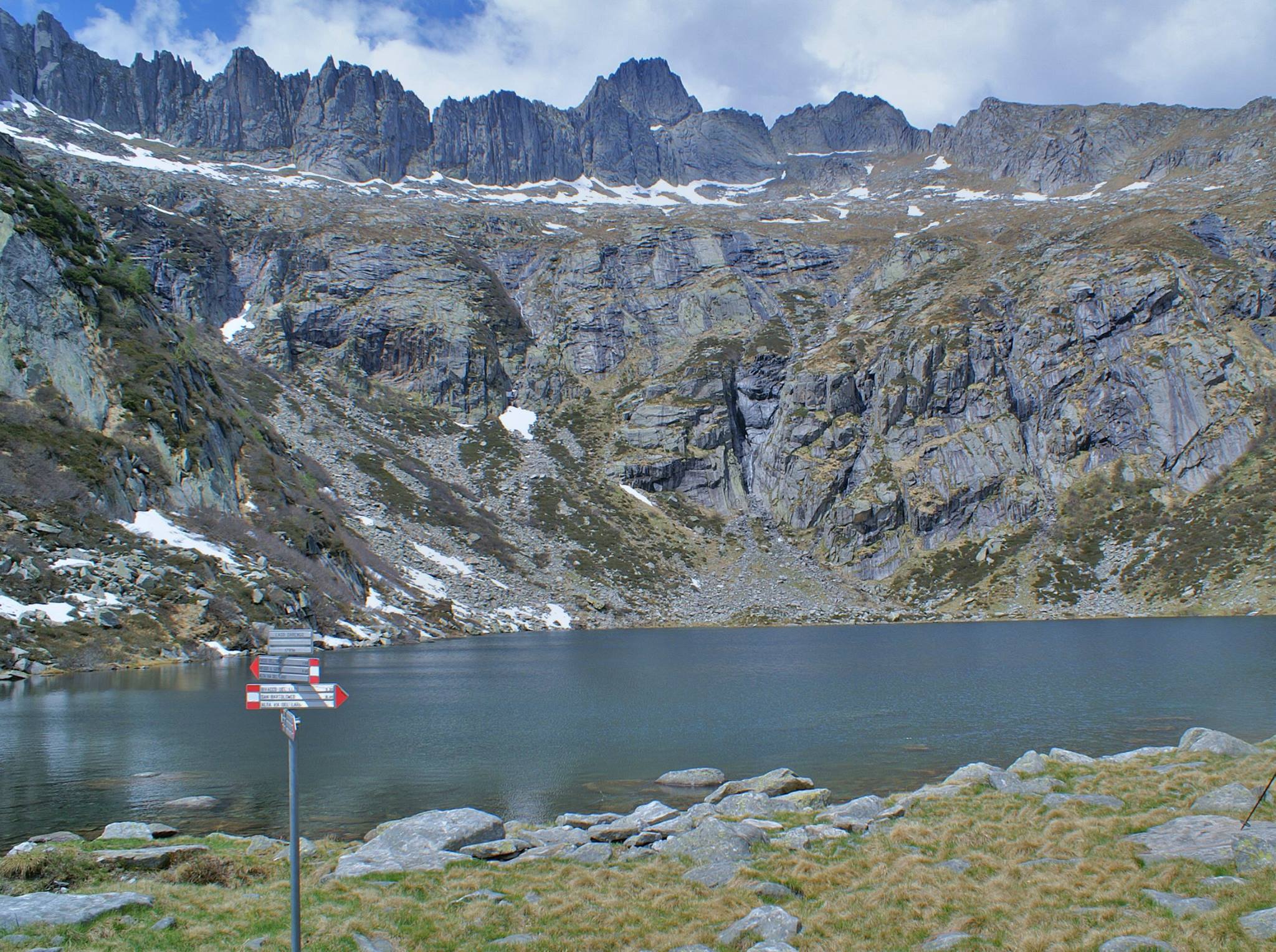
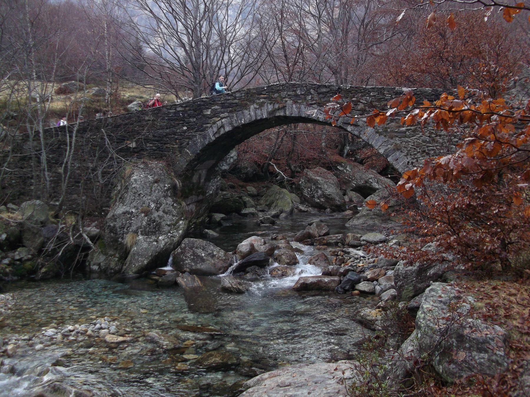
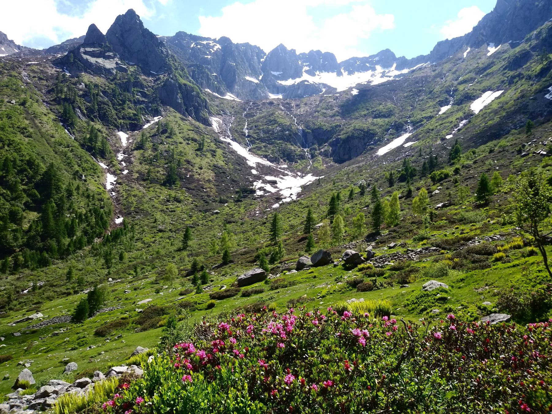
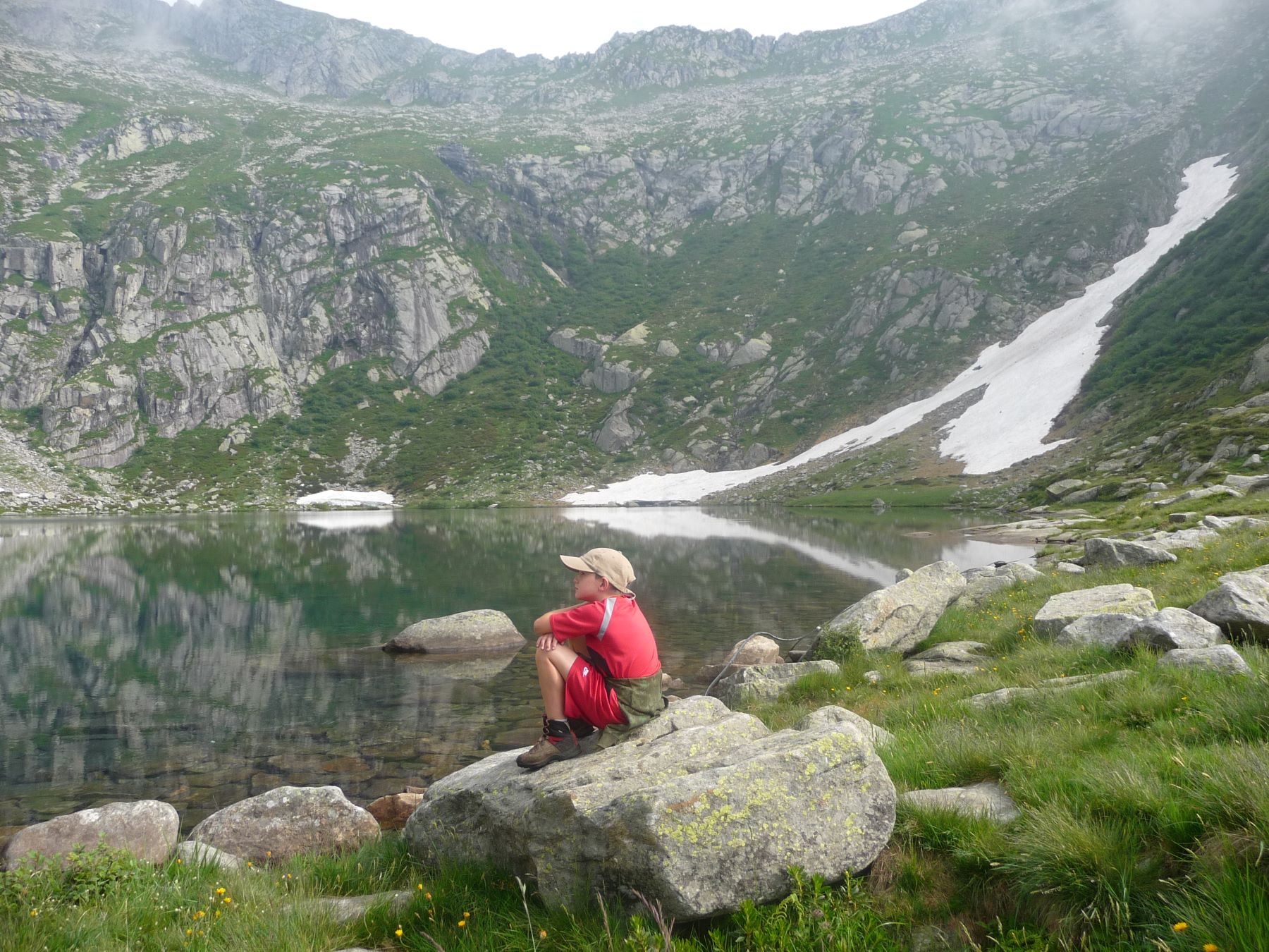
At an altitude of nearly 2000 metres hidden at the end of a glacial valley and surrounded by pinnacles of bare rock is Lake Darengo, a crystal clear mountain lake that’s fed nearly all year round by patches of melting snow. In the beautiful valley leading to the lake, full of streams and waterfalls, you are able to admire typical alpine vegetation. The hike is not difficult but one has to deal with its length and ascent. Possibility spend the night in one of the self catering mountain huts.

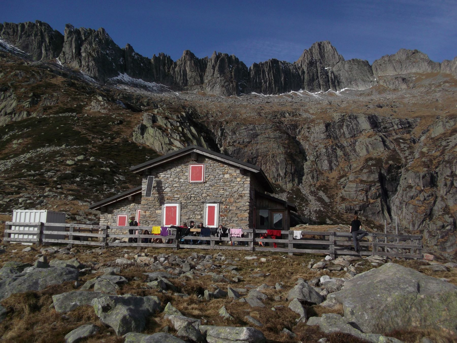
  • Rifugio Pianezza – at the moment closed due to works. For information on the reopening of the hut contact the municipality  of Livo tel. +39 0344 89761
  • Rifugio Capanna Como reservation on-line  www.caicomo.it

Description

Car route to Livo: Leave the state road SS340 at Gravedona and follow the provincial road S.P. 4  direction Peglio, Livo and Dosso del Liro.  Just before arriving at the town Peglio stands the church Saint Eusebio from where you have a superb view of the valley and of the lake. Worth a stop.  From Peglio cross the Pian dei Gorghigli to Livo. From Livo take the forest toll road (quite narrow at at some places bumby) in the direction of Dangri.  The fee of 3 euro is payable at the toll machine near the bus stop of Livo. Parking possibility at the cemetery slighly out of the town or at Dangri (4 km) where there are some parking spaces.

Itinerary: the ones travelling by bus get off at the bus terminal at Livo (665 m). Cross the village following the trail signs n°4 of the Via dei Monti Lariani, a trekking route of 125 km that runs along the west side of the lake connecting the rural mountain settlements. Livo still largely conserves its original urban structure. Most of the houses show the characteristics of country architecture.

At the exit of the village you follow the forest road leading to Dangri. You soon reach the cemetery where the beautiful 14th century church S. Giacomo stands. It has a beautiful apse with frescoes of the XV century.
The road descends among chest nut woods into the Val di Livo.  At  Dangri  (659 m 0.45 min), where there is a typical  inn, cross the beautiful old Roman bridge over the Livo stream. Once on the other side of the bridge turn left leaving at this point the Via dei Monti Lariani n°4 which continues to the right.
From here onwards you follow the red white red trail trailmarks painted on rocks and trees.

A beautiful ancient  mule track leads up in 40 wide bends to the settlement of Baggio, passing by the small baroque Sanctuary of S. Anna. From the fountain on the left of the settlement (970 m, 1h 35 min from Livo), you follow the trail along the steep slopes, into the valley. You reach a bridge which you cross. From here it goes uphill to Borgo, a group of mountain huts.
The path continues along the stream and reaches another bridge which you do not cross. After a long stretch through beech woods you reach a beautiful pasture called Pianezza (1260m, 3h 00 from Livo). On the other side the splendid old stone bridge stands Rifugio Pianezza.

You do not cross the bridge but you continue on the left side of the stream through the valley with its beautiful vegetation and little streams. You reach Alpe Darengo (1380 m, 3h 45 min from Livo). Paying attention to the signs you cross the pasture and then arrive at the rocky stream bed which you cross. From here the steep final climb to the lake starts. The crystal clear mountain lake is surrounded by a arena of pinnacles of bare rock.   On the edge of the  lake, which  is about 10 meters deep, stands Capanna Como (1790 m, 4h 50 min from Livo).

Note: Lago Darengo is situated on the Alta Via, a 4 day trekking route that only expert hikers should undertake. The starting point is S. Bartolomeo, above Gera Lario. Then the track passes Bivacco Ledù on lago Ledù, lago Cavrig, lago Darengo, Bivacco Zeb, Rifugio Sant Iorio, Rifugio Sommafiume and ends at tRifugio Menaggio.


Directions & Parking

Map directions →

Parking

Livo can be reached by car by leaving the state road SS340 at Gravedona and following the provincial road S.P. 4 in direction Peglio, Livo and Dosso del Liro. From Livo take the forest road (attention toll road) direction Dangri.  The fee of 3 euro is payable at the toll machine near the bus stop of Livo. Parking possibility at the cemetery slighly out of the town or at Dangri (4 km) where there are some parking spaces.

By public transport

Bus line C10 to Dongo bus stop Convento Francescani
From bus stop Convento Francescani at Dongo  bus line C18 to Livo.