[Skip to main content]
4 Valley Trail Alpe Erba

The 4 Valley Trail

Trekking routes

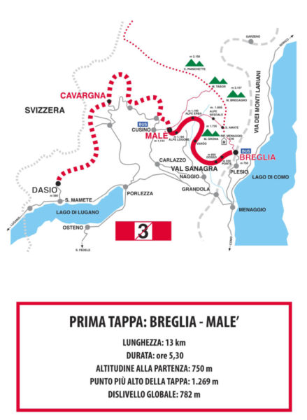
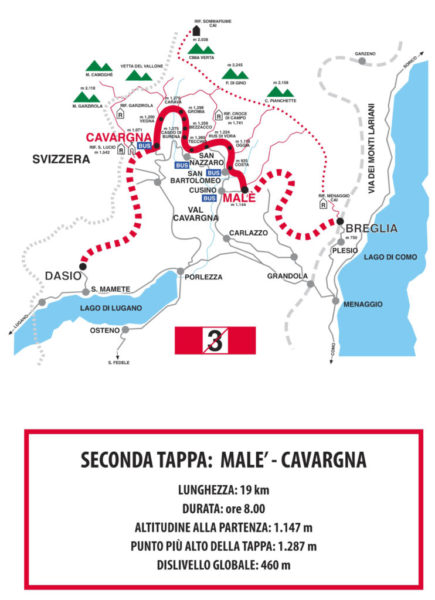
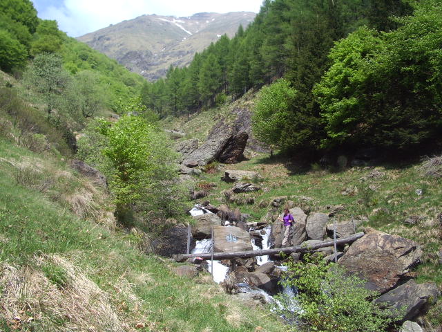
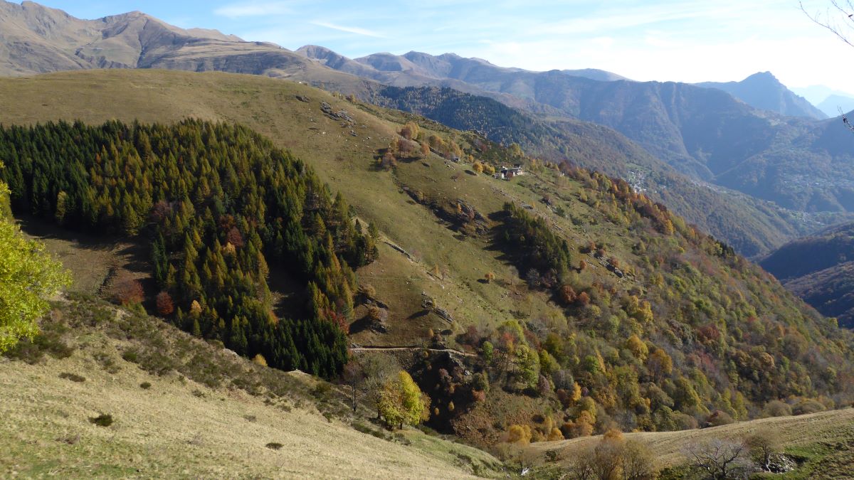
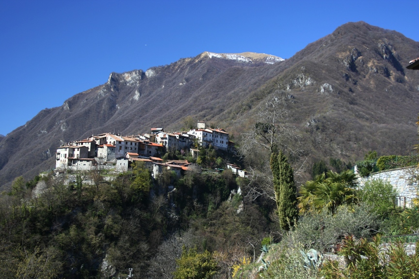
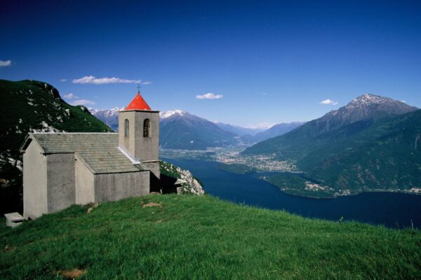
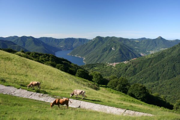
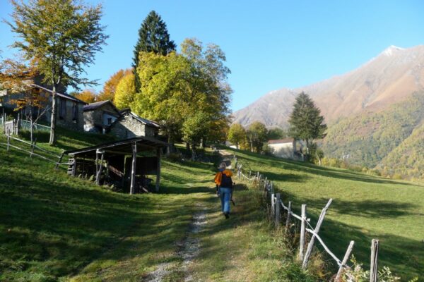
The 4 Valley Trail is a beautiful 3 day hiking route of 50 km between lake Como and lake Lugano. It starts at Breglia, a small mountain village, 7 km above Menaggio and leads through 4 different valleys: the Val Sanagra, the Val Cavargna, the Val Rezzo and the Valsolda ending at Dasio, a little town situated above S. Mamete on Lake Lugano.
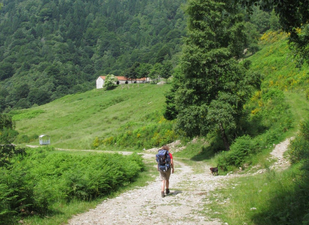
The trail is divided into 3 sections. The first one leads from Breglia to Malé and is 13 km long, the second section starts at Malé and ends at Cavargna and is about 19 km long, and the third leads from Cavargna to Dasio (13 km).
You can walk each of these sections as a day-excursion, or you can hike for three days.  In the brochure attached in the pdf you can find a listing of accommodation, along or not far from the trail.
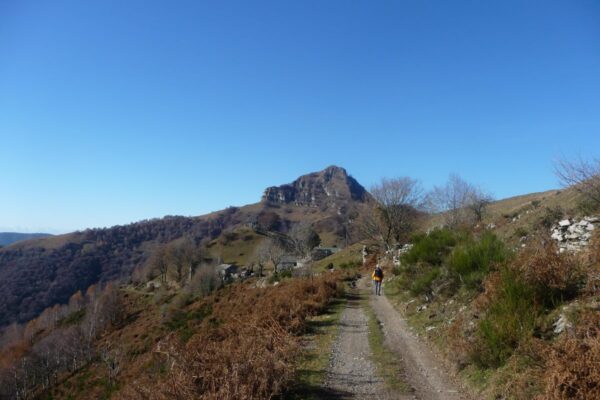
The trail follows average height of about 1.000 meters and reaches  its highest point of 1.400 m at Alpe Coloné in Val Cavargna;  it is marked by red-white-red signs with a number 3 crossed with a red bar.
The times indicated in the description are for experienced hikers. The ideal time of the year for this hike is from May till the end of October.

Available maps: “Carta Topografica Escursionistica” Val Menaggio, Val Sanagra, Val Cavargana, Valrezzo, Valsolda by the Comunità Montana Valli del Lario e del Ceresio scale 1:25.000, or the “Kompass map n° 91″ scale 1:50.000

Description

FIRST SECTION – from Breglia to Malé
This part of the trek will lead you through the Val Sanagra once full of alpine pastures and farms many of which are now abandoned.

Breglia (749 m) can be reached by bus (line C13) from Menaggio (7 km). In order to find the beginning of the 4 Valley Trail, from the bus stop at Breglia go back slightly along the road, pass in front of the hotel Albergo Breglia and enter the village following the trail signs. Breglia is also crossed through by the Via dei Monti Lariani, a hiking trail of 125 km which starts at Cernobbio and runs to the northern end of the lake connecting the small rural settlements scattered along the slopes on the west side of the lake. During the first part of your walk you will find the signs of both trails as, for a small stretch, they follow the same itinerary.
Leave the village Breglia behind you and enter the woods. Cross a small wooden bridge near the spring of Troi and then continue uphill. You reach the area called Ponte where the path leads on to a small road which you follow downhill to the pastures of “La Piazza”. At the intersection where there is a little chapel, called “del Bergum” turn right. Pay attention, the two trails split here. The 4 Valley Trail leads immediately again to the right, the Via dei Monti Lariani continues straight on, so turn right.
The cart track leads through the pasture  and then enters the woods. It passes the area called Ferée and then reaches Monti Dosso (850 m  1.00 hr) with a beautiful view of Lake Como and of the Val Sanagra valley. Here follow the cart track leading down to the right. You enter the Val Sanagra on a trail half way up the steep south west face of Monte Grona, crossing some streams. You arive at Monti Stanga (872 m) where there are some farmhouses in the shade of big chestnut trees.  You reach a fork above Monti Tampiglia (864 m 0.40 ; 1.40 hrs) where you take to the right.
The path leads uphill and crosses some streams, and then turns to the west face of Monte Grona. You now enter a wooded area called Bosco di Varòo. You walk among tall trees with thick undergrowth and after crossing the stream Varòo, the path leads on to a vast meadow, just below the restored mountain hut of the ancient farm Alpe Varoò (1.141 m 1.10 ; 2.50 hrs). Ascend the meadow in order to reach the continuation of the path. After a stretch through thick woods with lots of high conifers and beech trees the path reaches the river Sanagra (1.200 m) which you can cross without any problems if the water is at a normal level. Then the trail goes up steeply and comes out on the cart track leading up from Naggio. Follow this track downhill for about 1.2 km to the pastures of Alpe Erba (1.190 m 1.10 ; 4.00 hrs). Continue downhill on the cart track for another 1.7  kilometers, then leave it and pick up a cart-track closed by a bar on the right. Follow this track uphill and you arrive at the beautiful pasture of Alpe Logone (1.184 m 1.00 ; 5.00 hrs) which is the watershed between the Sanagra and the Cavargna valleys. You walk past the farm house where excellent cheese is made during the summer months. At the far end of Alpe Logone pick up the cart-track leading up to the right (see note below) and after about 100 meters you reach a small parking place. The ones continuing the walk turn right and continue per second section below. Those spending the night at  Malé (1.144 m 0.30 ; 5.30 hrs) must turn left; Locanda Maria at the far end of the village offers accommodation and meals.

Note:
For those walking this section as a day excursion: at the far end of Alpe Logone pick up the road leading down to the left to Cusino (40 min) When you arrive on the main road at Cusino, turn right and after 100 meters you’ll see the bus stop (line C14 Cavargna-Porlezza-Menaggio).

Note: during the summer months you can follow an alternative route between Breglia and Alpe Erba which offers a more open view. The length is about the same but with a total ascent of 1066 meters instead of 782 meters. From Breglia, follow the trail in the direction of rifugio Menaggio. After about a 50 minutes walk, you reach a fork with the sign Rifugio Menaggio / Monte Bregano / S. Amate, here head right in the direction of S. Amate. From the chapel of s. Amate (alt. 1600 m) the spectacular view embraces Lake Como, the woods and pastures of the Val Sanagra, Lake Lugano and the Alps. From the saddle of S. Amate follow the level trail to the farm house of Alpe Nesdale. From here you descend the path that leads down into the Val Sanagra and after crossing the stream bed, you reach Alpe Pisnera and shortly after, Alpe Levea 1,308 altitude). from here continue downhill on the cart track for 600 meters and you will find yourself on the 4 Valley Trail on your way to alpe Erba.


SECOND SECTION – from Malé to Cavargna
The second section of the walk is the longest and leads completely through the wide catchment basin of the Val Cavargna. The valley is rich in water,  vegetation and contains ancient settlements surrounded by mountains more than 2.000 meters high.

  • Lenght: 19 km
  • Duration: 8.00 hours
  • Altitude at departure: 1.147 m
  • Maximum altitude on this section: 1287 m
  • Global ascent: 460 m

Malé (1.144 m) can be reached on foot (40 min) or by car from Cusino by following the sign for Alpe Logone (see note at the end of the first section).  From the car park just before the hamlet Malè pick up the wide track that leads into the direction of Alpe Rozzo. Leave it almost at once and pick up the trail to the left that leads through the woods (follow the signs on the trees). The trail then runs downhill across numerous streams, that then reaches the bridge over the river Cuccio di San Bartolomeo, which you cross. The trail then leads uphill through the woods to the green meadow land of the village,  Costa (925 m 1.00 hr).
Keep to the upper part of the village and follow the path that leads slightly uphill, which eventually reaches the road. Cross it and pick up the continuation of the path which passes the house called Selva.  Just past the house, pick up the path to the right that leads through chestnut woods and beech woods. You meet the track leading up from San Bartolomeo and follow it to the left to the settlement of Vraccia. At the beginning of the village, go up to the right in order to reach the church. Just above the little church, you once again reach the road that finishes at the neighbouring settlement Oggia (1.118 m 0.30 ; 1.45 hrs). Cross the road and walk through the charming village, and followthe signs on the houses.
From Oggia, the path leads over steeply sloping meadows, to Piazza Mezzana in Val dei Molini. When you get close to the stream, the path leads down to the left and soon reaches a concrete footbridge over the stream Cuccio di Sebol in the Val dei Mulini (1.134 m 0.30 ; 2.15 hrs). Here you’ll notice the entrance of an old abandoned iron mine used until the end of the 19th century. The path then follows the right side of Val dei Molini, continues uphill and passes through the upper part of Darni (1.135 m).
Here the trail ends onto the road leading up from San Bartolomeo, which you follow uphill for about 300 meters. Take the path to the left that leads into the settlement of Rus de Vora Inferiore (1.224 m 0.45 ; 3.00 hrs).
(From here it’s possible to make a detour to the Rifugio Croce di Campo  (1.15 hrs), to the top of Pizzo di Gino (2.245 m  3.30 hrs) or to Cima Pianchette (2.158 m  3.00 hrs).
We recommend a small detour to the little church “La Regina dei Monti” up on the right with a marvellous view in every direction. Back on the trail, which is not very evident here, it goes slightly downhill over a wide pasture.  The trail enters the Val di Lana valley and without any difficulty you cross the stream. After a stretch of about 300 meters, at a fork,  pick up the path to the right,  which leads steeply uphill to a beautiful view point. The beautiful view embraces Monte Galbiga (1698 m) in front, the slopes of Monte Garzirola (2103) to the right. You then soon reach Tecchio (1.280 m 0.40 min ; 3.40 hrs) where there are some wooden huts and a fountain. Behind the huts, two flights of steps lead up to a rural road that connects the town San Nazzaro  (it is possible to reach the town in 40 min where there is a bus stop for the line C14) with the mountain shelter Rifugio Croce di Campo (1.741 m – 1.30 hour from Tecchio)) and the pastures of Piazza Vacchera  (from the rifugio it’s possible to ascend Pizzo di Gino 2.245 m).
Cross the rural road and pick up the trail that leads into a pinewood. The path reaches a waterworks cabin, where there is a fountain. Here you pick up the trail on the left, which runs around the Val Ruina.  Just out of the conifer woods near another waterworks cabin you pick up the trail to the left and follow it slightly downhill to Casdo di Burena (1.275 m 0.40 ; 4.20 hrs) a picturesque group of mountain huts. The original rye straw roof coverings have been replaced by rusted corrugated iron.
Go right and keep to the upper part of the settlement; walk to an isolated white house on the ridge, keep to the left of the house, and pick up the trail near a birch tree. The path then goes off in the direction of Valle Piazza, an area plagued by disastrous floods. At Monti Bezzaco (1.259 m 0.30 ; 4.40 hrs) keep to the left and follow the trail down through a meadow at the edge of a landslide. At the edge of the meadow, a small, steep trail leads down across a few small streams before reaching the larger stream below. After crossing it, a nice trail goes up to the  farmhouses of Piazza (1.179 m) just above the settlement Fous.
The path continues to the farmhouses of Monti Gromia (1.298 m 0.25 ; 5.20 hrs) and from here, at first a not very evident trail, leads along the mountain side, through steeply sloping meadows to the scattered farmhouses of Monti Carava (1.275 m 0.30 ; 5.50 hrs) in the shade of beech and maple trees. Going slightly downhill, you descend to the river Cuccio di Cavargna at a height of 1.200 meters, dominated by the impressive peaks of Mount Cima Verta. A bridge makes it possible to cross the river.
The trail then ascends, through a thick state forest plantation. Then going downhill and crossing another stream you get on to the mule track leading up from Cavargna near the hamlet of Monti Collo(1.200 m 1.10 ; 7.00 hrs) inhabited all year round.  Follow the road to Monti Dosso but just before the town you pick up the descending track to the left which passes just below the hamlet. You then skirt the little cemetery of Finsue and pick up a  not very well defined path which leads in bends into the Val Segur valley, which you cross over an  iron bridge.
After a stretch through  beautiful woods you arrive at Cavargna (1.071 m  1.00 ; 8.00 hrs), the highest commune in the province of Como. We recommend a visit to the ethnographic  museum“Museo della Valle” near the parish church, that illustrates the local traditions and customs but also the smuggling and migration phenomenon due to hard living conditions in the valley tel. 0344 63162. The bus stop is 50 meters past the parish church.


THIRD SECTION – From Cavargna to Dasio
This section of the trail leaves the Val Cavargna just below the mountain pass S. Lucio (on the Swiss/Italian border) and enters the green and wooded Val Rezzo passing through the village Seghebbia. From there it goes on through the rocky Valsolda.

  • Lenght: 13 km
  • Duration: 5.00 hours
  • Altitude at departure: 1071 m
  • Maximum altitude on this section: 1400 m
  • Global ascent: 517 m

Cavargna (1.071 m), the highest commune in the province of Como, can be reached by bus line C14 from Menaggio or Porlezza. Leave Cavargna through the upper part of the town by taking the trail on the left side of the church, which ascends steeply to the  Colonia (holiday camp); the path then skirts a beech wood called ‘Bosco Sacro‘, which forms a natural barrier against avalanches and landslides and then leads into the narrow and steep Val Marda.
After crossing the bridge over the stream in the Val Molino, the trail ascends on the opposite side of the valley. At the fork, turn right and follow the track through the pastures to the top of the slope to the settlement Monti Coloné(1.400 m 1.20 hrs from Cavargna) from where the view embraces the valley of Cavargna. (From the fountain in the middle of the settlement it’s possible to make a detour to the 14th century  church of  San Lucio (0.30 min) situated on the Swiss- Italian border; close by stands the refuge “Rifugio San Lucio”).
From Monti Coloné, keep to the cart track which enters the woods and leads to Roccoli situated on the watershed between Val Cavargna and Val Rezzo. The trail meets the cart track leading up from Buggiolo to Passo San Lucio. You follow it downhill to the left, to the fountain near the chapel called  Madonna del Cepp (picnic area) from where there is a lovely view of the Valrezzo. You leave the cart track and pick up the path to the right, which descends through a beautiful beech wood (pay attention to the signs on the trees). You then cross a stream just before getting to some farmhouses situated above the village of Seghebbia (1.100 m 0.55 ; 2.15 hrs).
Pass through the town (follow the signs on the houses) and then follow the road for about 50 meters. Just past the cemetery, leave the road and descend to the right. Walk through the green meadows, passing some farmhouses, to a stream. Cross the stream and follow the ascending trail through the woods which ends in a beautiful clearing with an antique farmhouse called Pramarzio (1.061 m 0.25 ; 2.40 hrs) which used to be an important resting point for the local smugglers called “contrabbandieri”.
The path then enters a beautiful little valley that connects Val Rezzo with Valsolda. It leads through a beech wood to end up at Pralungo (1.116 m). At the end of the meadow the trail re-enters the woods, crosses a stream, and leads to Alpe Riccola (1.037 m 0.25 ; 3.05 hrs). The landscape here resembles the Dolomites: rocky limestone mountains, pine and larch trees, and lots of water.
The path follows the stream of the Val Riccola and leads to Passo Stretto (1.102 m 0.40 ; 3.45 hrs) a narrow passage where you leave Val Rezzo and enter Valsolda. The trail then descends, offering nice views of the Lake Lugano basin.
The “Regione Lombardia” owns 318 hectares of woodlands in the Valsolda and in 2007 the whole forest was declared Nature Reserve, in order to preserve its important natural features, its endemic species, and its rich fauna. In the reserve, several nature routes have been set out.
The trail now goes down steeply, closed in by the valley, and passes some cabins with picnic area that are part of the Nature Reserve Valsolda. From here, a comfortable cart track that passes along the gorges of the valley leads down to the green slopes of Ranco’ (760 m 0.45 ; 4.30 hrs). The track continues to the head  that is surrounded by the limestone peaks of Pizzo Ravé (1285 m), Monte pradé (1607 m) and Sass di Mont (1262 m). At the next intersection proceed to the left. A steep track winds down to the bottom of the valley and, after crossing the bridge over the stream Soldo at a height of 617 m, you arrive at the village Dasio (580 m 0.30 ; 5.00 hrs). The Sentiero delle 4 Valli finishes here. From Dasio there is a bus connection to Porlezza. Mind that the last bus leaves quite early and on Sunday does not run. Near the bus stop, via Marisem followed by a series of tracks, lead down to San Mamete (0.45 min. on foot) to the bus stop of line C12 (Menaggio-Porlezza-Lugano).

The 4 Valley Trail – LODGING AND CATERING LIST

Always book before starting each section. The indicated opening days are not always respected.

  • Albergo Breglia                       Tel. +39 0344 37250
    Breglia
  • Rifugio Menaggio                   Tel. +39 0344 1930017
    1.30 hours from the trail
  • Locanda Maria                         Tel. +39 3332231667
    Malé
  • Baita Malé                                   Tel. +39 3473171533
    Malé
  • B&B La Ca’ Rossa                    Tel. +39 3494194095
    Cusino
  • Affitacamere Ca’Vada         Tel. +39 3392270823
    San Bartolomeo
  • Rifugio Croce di Campo       Tel. +39 3713869842
    1.30 hours from the trail
  • B&B Val Cavargna                  Tel. +39 3332420385
    San Bartolomeo V. C.
  • Il Grigio                                      Tel. +39 3479138907
    San Bartolomeo V. C.
  • B&B Bugna Odetta                  Tel.+39 3388793603
    San Bartolomeo
  • COLONIA                                     Tel. +39 0344 63164
    Cavargna
  • Trattoria Baroni                      Tel. +39 3392082095 
    Cavargna
  • Gatto Nero                                  Tel. +39 339 5053434
    Cavargna

Directions & Parking

Map directions →

By public transport

Bus line C13 from Menaggio to Breglia