[Skip to main content]
Rifugio Menaggio on the south slope of Mount Grona

Rifugio Menaggio

Hikes

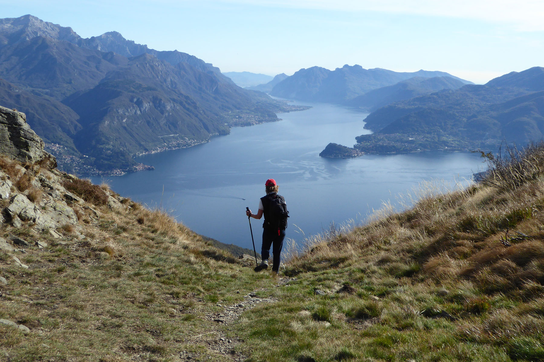
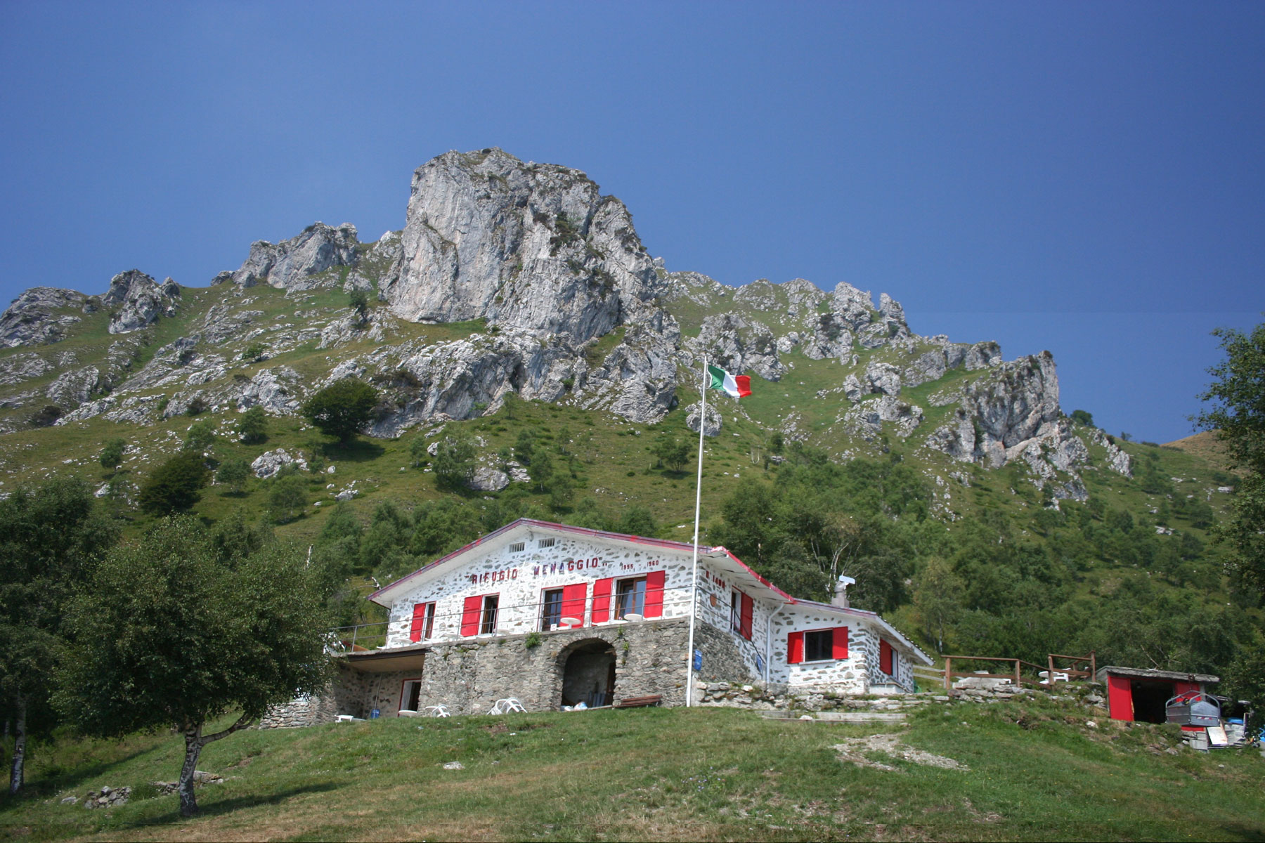
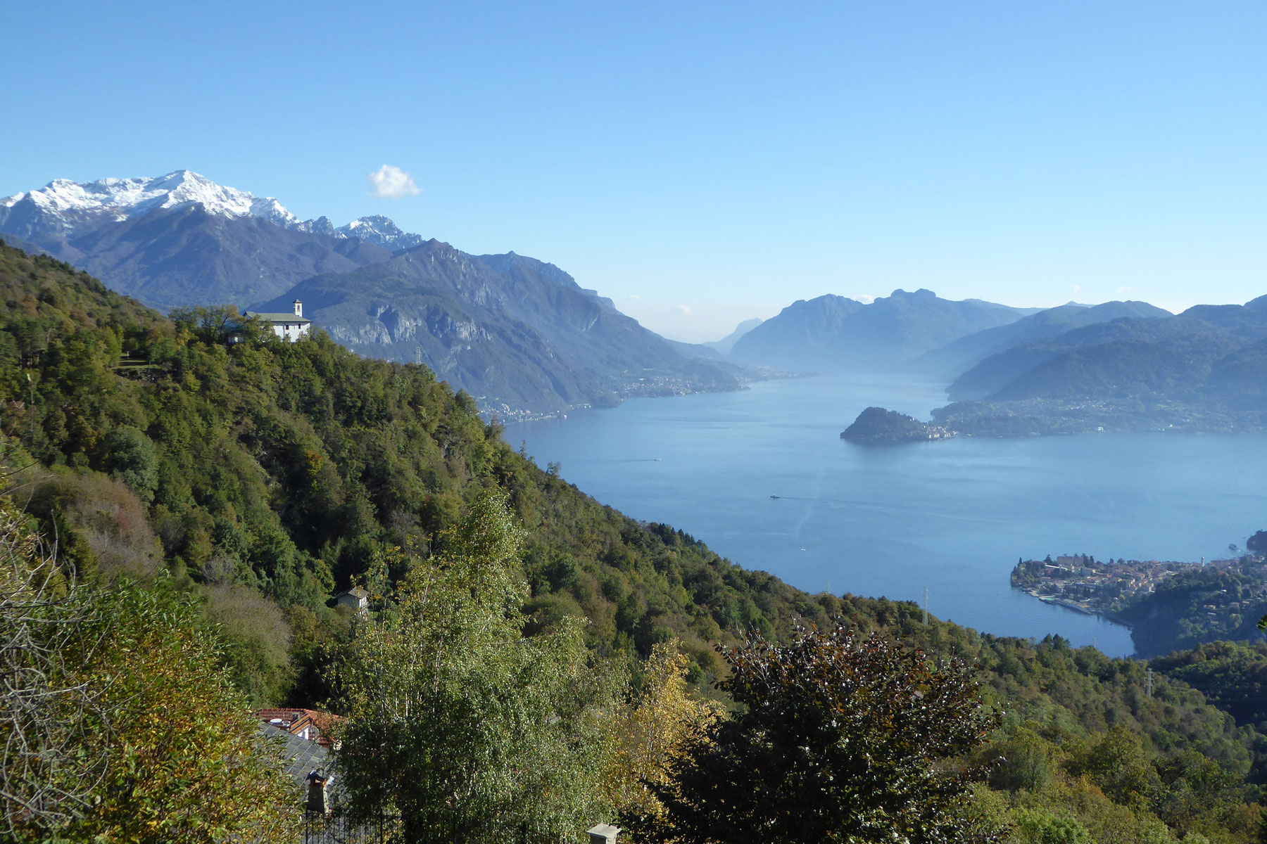
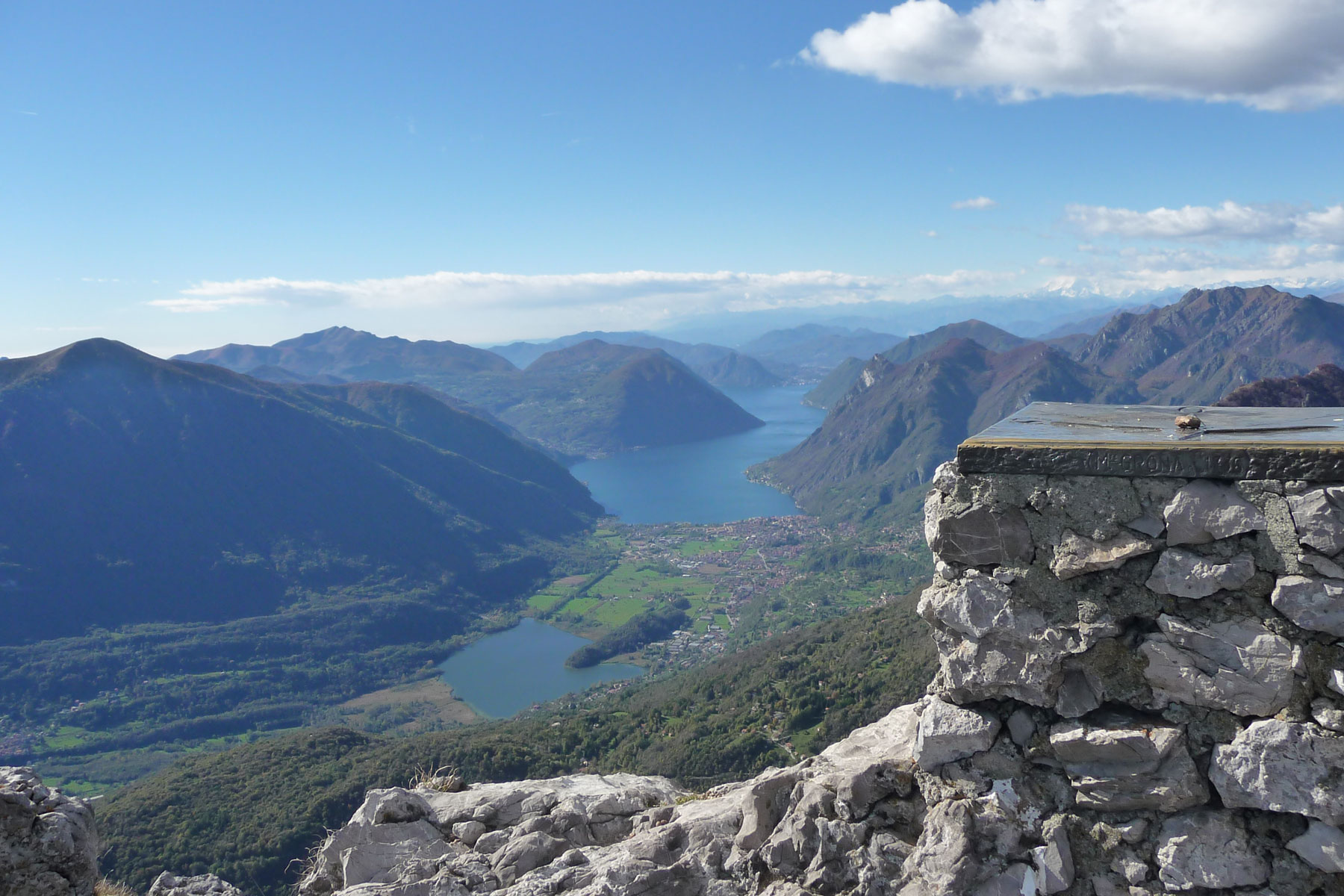
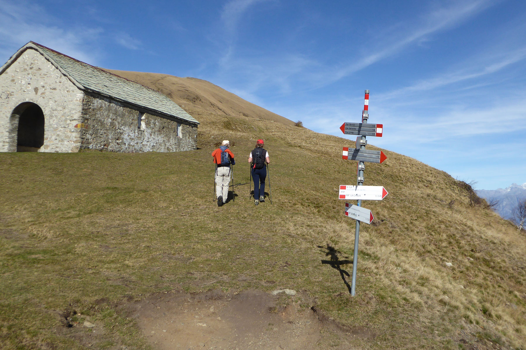
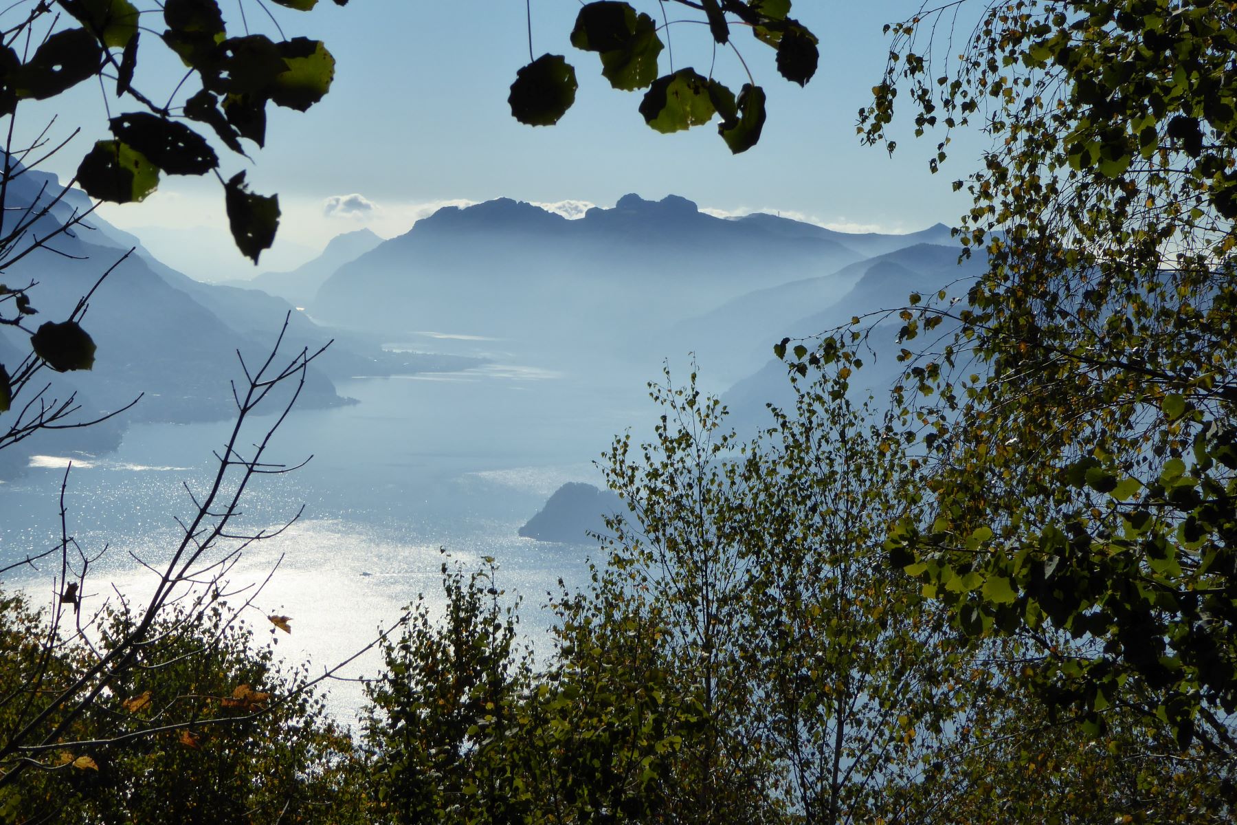
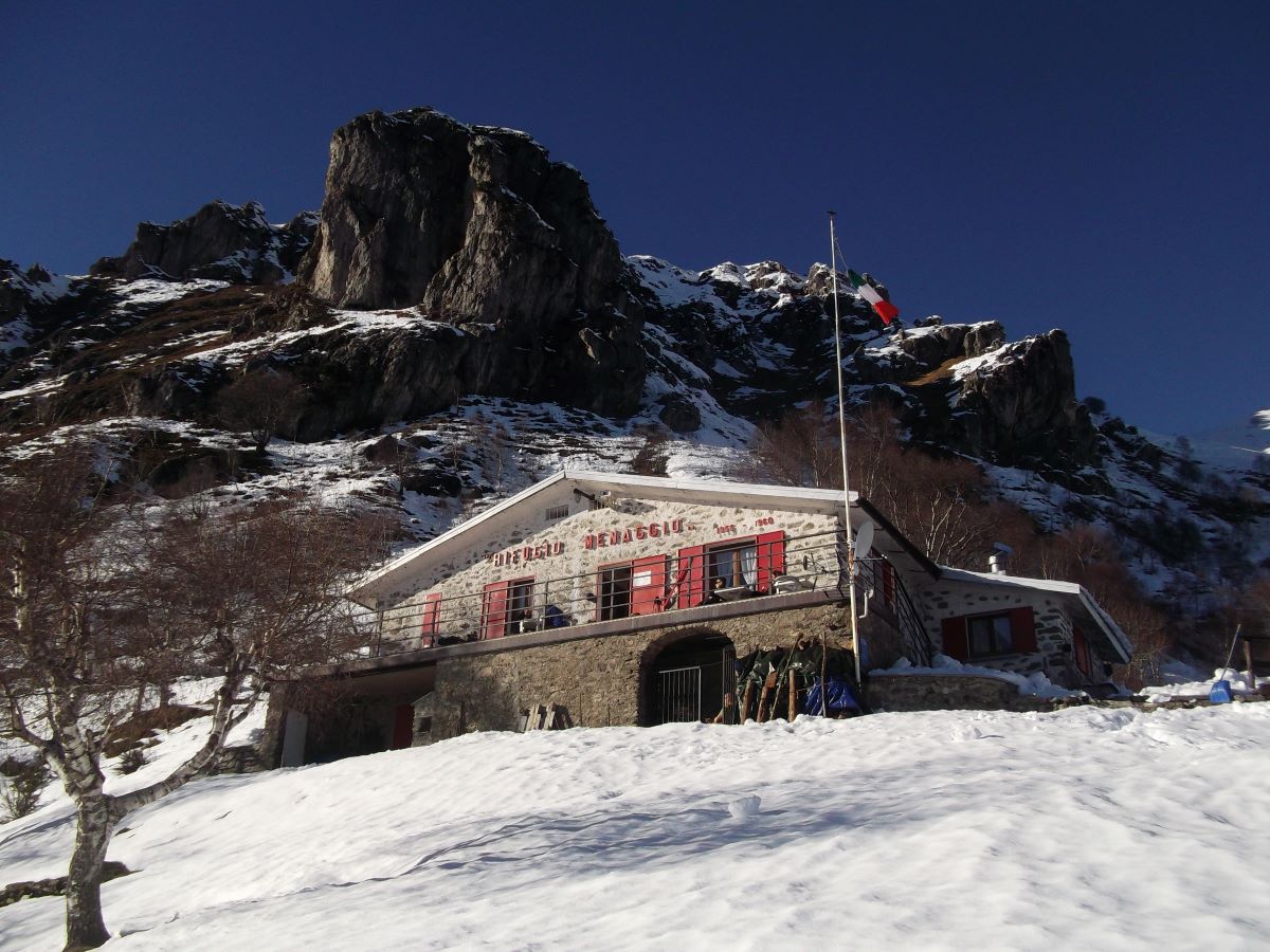
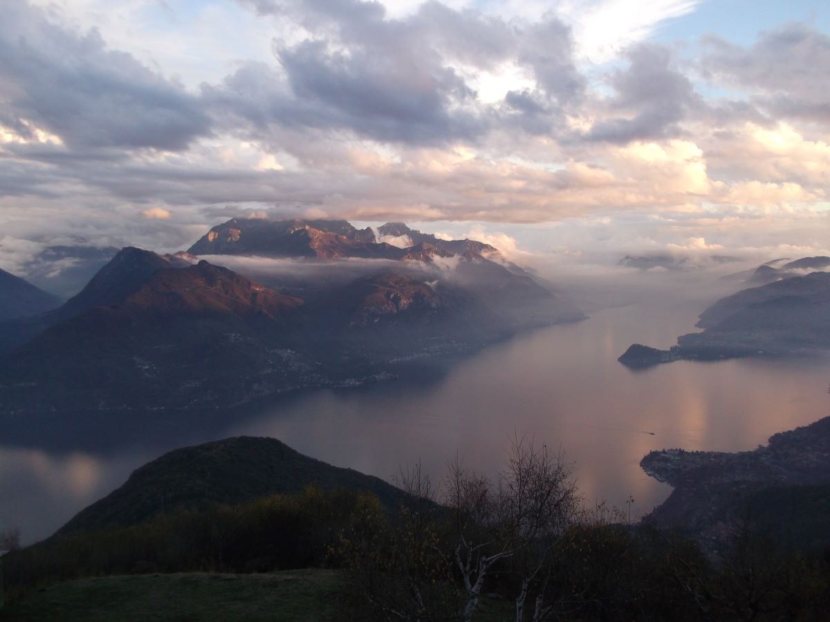
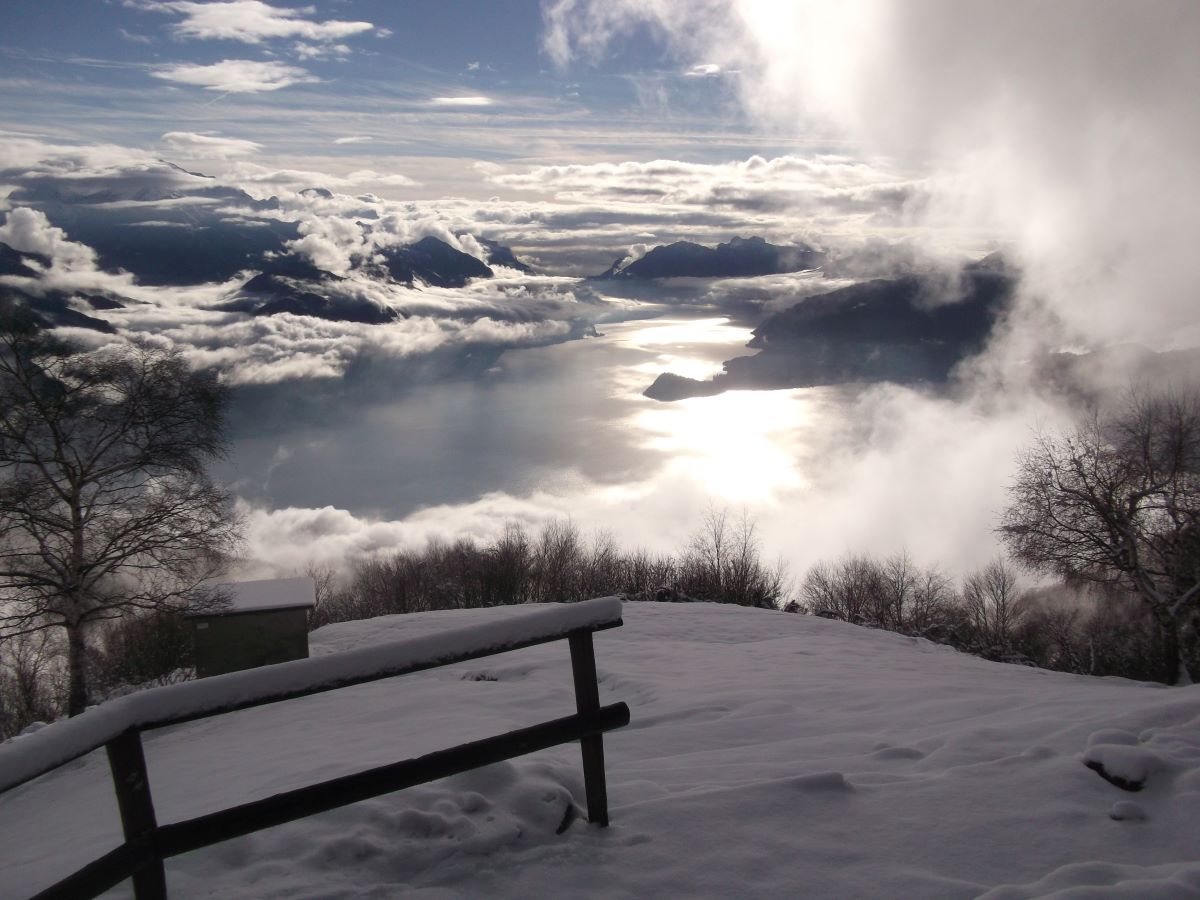
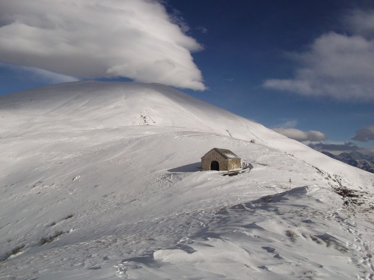
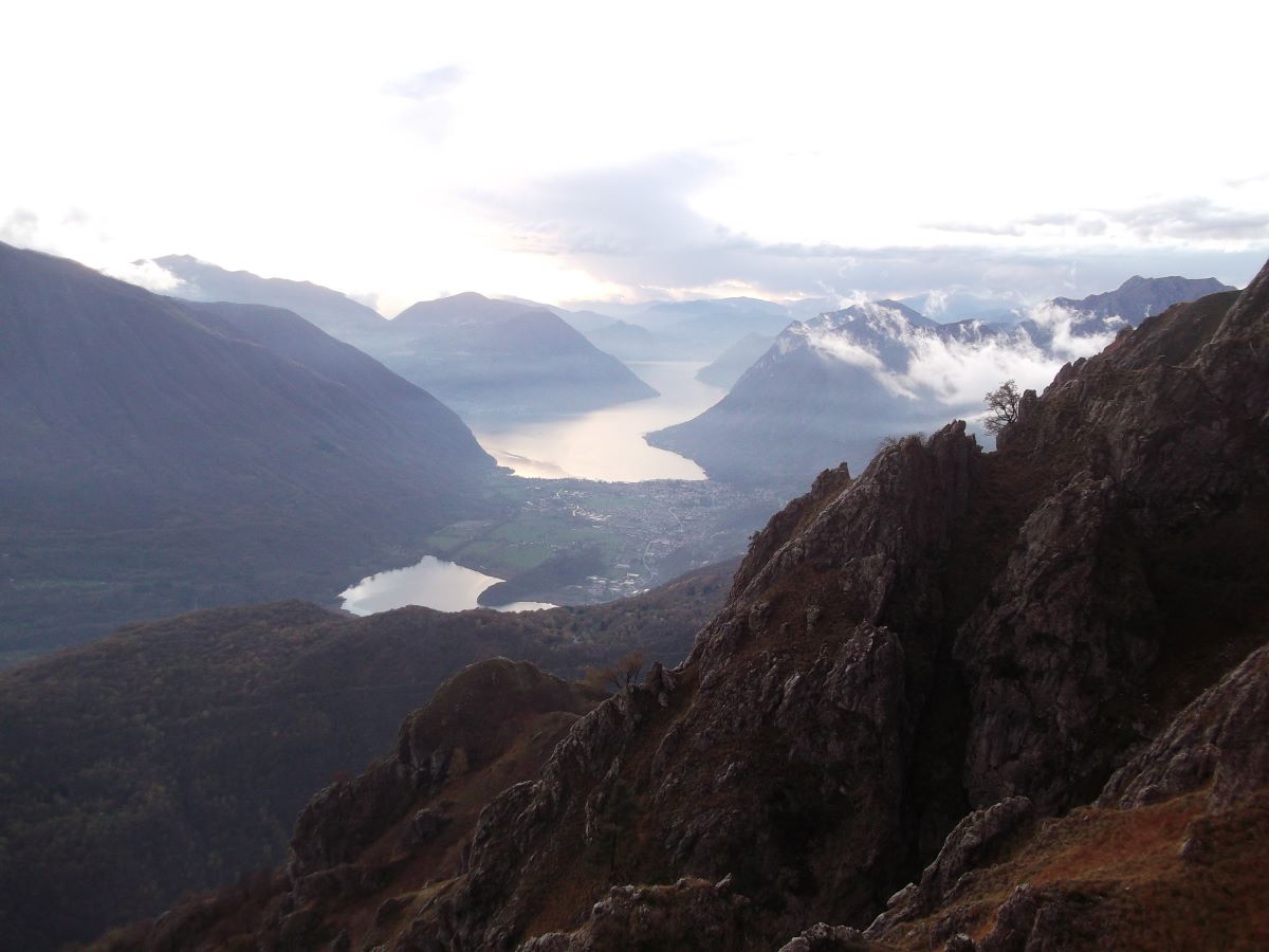
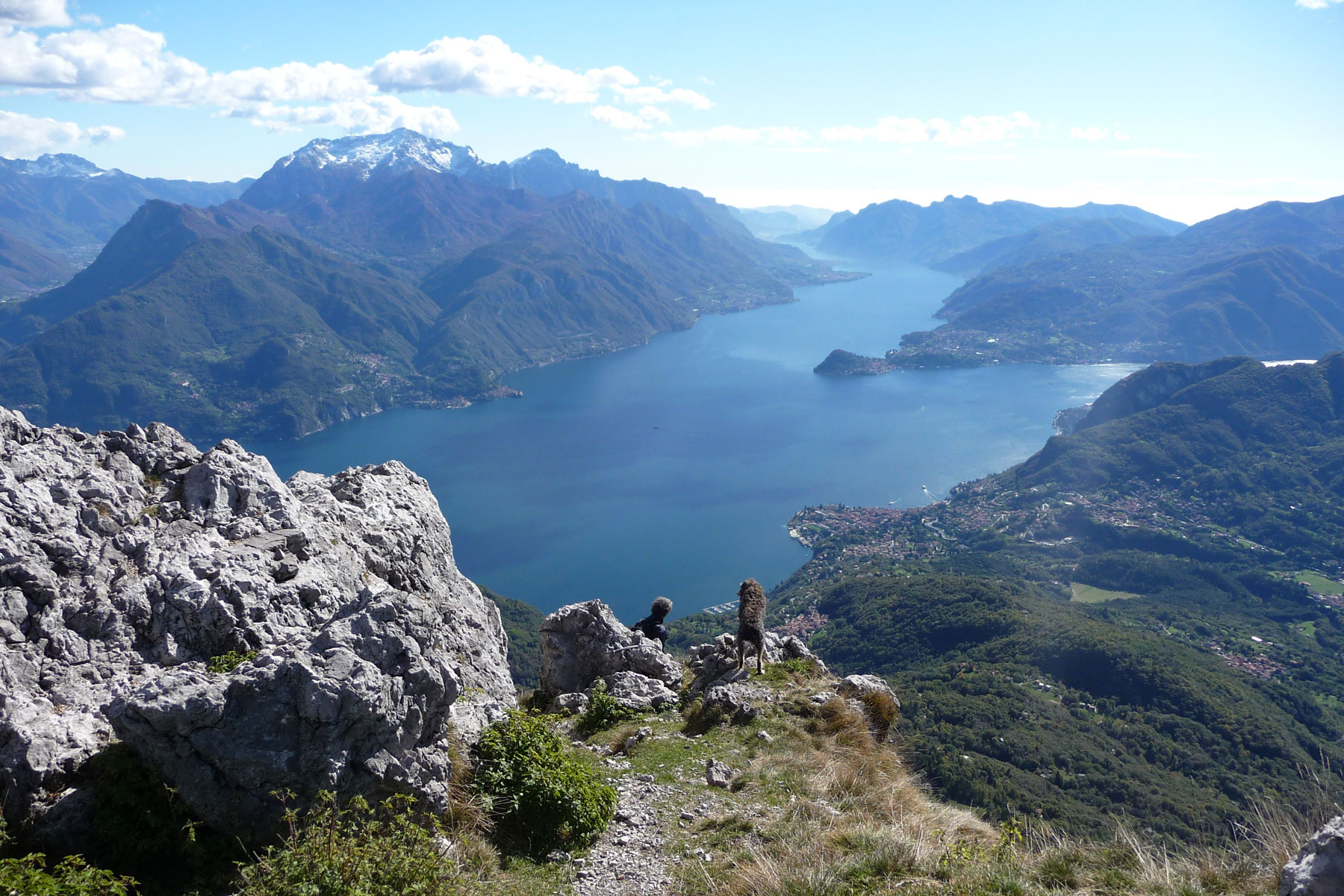
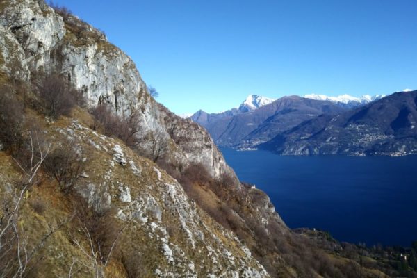
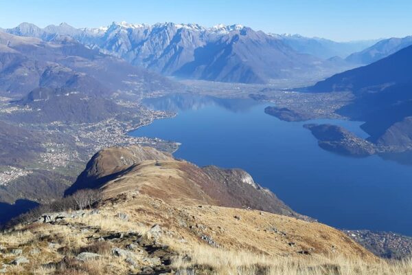
Rifugio Menaggio (1400 m) is situated on the southern slope of Monte Grona where one can enjoy a spectacular view of Lake Como and the surrounding mountains. From the rifugio you can extend your hike to Monte Grona (1736 m) and to Monte Bregagno (2107 m).

The rifugio provides refreshments and lodging and is open daily during the summer – the rest of the year on Saturdays Sun- and Holidays. For information and reservation tel. + 39 0344 1930017 or +39 375 5108734

Description

Breglia is a small mountain village situated in the commune of Plesio, 7 km above Menaggio.  From the bus stop at Breglia (749 m)  ascend the small road leading up to Monti di Breglia (sign indicating Rifugio Menaggio). At the second bend, just beyond a fountain, take the first short-cut to the right (sign Monti di Breglia/Rifugio Menaggio). It ends up on the road again, which you cross to pick up the next shortcut.

After 20 m, at a fork, keep right. The trail leads on to the road once more, which you follow for about 100 m. The next shortcut on the left crosses a field. Cross the road another time and follow the trail through the woods which finishes on to the road at Monti di Breglia (1000 m).

Shortly after, you reach a picnic area with fountain and a beautiful view (you deserve a rest). Here you leave the road and follow the trail over some rocks up to the left (sign). You reach a parking area  which you cross and then pick up the trail to the left. At the junction take to the right (after heavy snow fall we reccomend the trail to the left). It leads among birch trees and broom up to the crossroads for S. Amate and Monte Bregagno.

Turn left. The now quite level trail leads along the slope of the mountain to rifugio Menaggio. The view embraces the whole central lake area with the towns of Menaggio with Monte Crocione (1640m), Bellagio with Monte San Primo (1682m) and the Corni di Canzo (the two horns of Canzo) and Varenna dominated by the Grigne (2410m).


WALKS FROM RIFUGIO MENAGGIO

Pizzo Coppa

Fifteen minutes from the rifugio there is a viewpoint called “Pizzo Coppa” from where you have a splendid view not only of Lake Como but of the whole Menaggio valley with Lake Piano and Lake Lugano. Not to miss!! Take the trail on the left side of the rifugio (facing the building).


Monte Grona 1736 m

From  Monte Grona you can admire one of the best views of the Pre-Alps. Apart from the three lakes Como, Piano and Lugano,  the close-by peaks of Monte Bregagno, Monte Legnone, Pizzo di Gino and Grigne,  you can also see many peaks of the Alps from Monviso to Bernina.

Ascents:

  • Via Normale – time: 1h15  ascent: 336 m
    The beginning of this trail starts behind the rifugio. At  the fork S. Amate – Monte Grona keep left and ascend to the saddle called “Forcoletta”.  Here turn left and follow the steep rocky exposed trail. A metal cable helps you along the final stretch to the summit.
  • Via Direttissima – Time: 1 hr  ascent: 336 m
    As this trail is exposed to the south, it does not accumulate much snow in winter but it is steeper and more exposed than the Via Normale. Behind the rifugio follow the indication for “Via Ferrata”.  Soon  you reach a saddle where you turn right and follow the indication for the “Via Direttissima” which climbs up along the south gully. At the end of the gully turn left crossing some rocks. A metal cable helps you along the final stretch to the summit.
  • Via Ferrata – Time: 3h00.
    Only for Alpinists with adequate equipment.


Sant’Amate (1623 m) time 0h45  – ascent 240 m)
Monte Bregagno (2107 m)
time 2h30 – ascent 707 m
From Rifugio Menaggio you can walk to the little chapel of Sant’Amate and from there to the top of Monte Bregagno. 

Behind the Rifugio follow the trail to “Forcoletta” and “Monte Grona Via Normale”.  At the bifurcation Monte Grona – S. Amate turn right. The trail leads  around the Val Pessina and reaches the grassy mountain ridge. From here descend to the saddle of S. Amate  and its chapel. The spectacular view embraces Lake Como, the woods and pastures of the Val Sanagra, Lake Lugano and the Alps.

If you wish to end the walk follow the indication for Breglia. The trail leads to a saddle called “el capel de Giuan” , (Johnny’s  Hat) in local dialect which eventually joins the path you followed previously from Breglia to rifugio Menaggio.

For those who wish to reach the top of Monte Bregagno, from S. Amate follow the grassy mountain ridge. Right at the start of a steep ascent you will pass the deviation for Rifugio la Canua 1520 m tel. + 39 3358097897. You reach the altitude of 1905 m (Bregagnino) from where the trail descends to  a saddle and then leads up again the rounded  top of Monte Bregagno. The view of Val Albano, Valtellina and the Mesolcine mountains to the north, Lake Lugano, Val Cavargna and the Lepontine Alps to the west and Lake Como with Monte Legnone to the east  is extraordinary.


Directions & Parking

Map directions →

Parking

Parking possibility at Breglia or at Monti di Breglia (1000m). Attention! Pay road fee if driving to Monti di Breglia (3 euro – coins only) at the ticket machine at the beginning of the road.

By public transport

From Menaggio you can reach Breglia by bus in 25 minutes with bus line C13.