This magnificent circular walk starts at Breglia (alt. 750 m) and leads along ancient mule-tracks through beautiful chestnut woods to the vast pastures of Alpe Rescascia (alt. 1413 m). From here a trail with a breath-taking view of Lake Como leads to Rifugio la Canua (alt. 1520). The shelter provides refreshments and lodging and is open from June till the end of September during weekends, August daily – for information tel. 335 8097897
Description
Breglia, where this walk starts, is a small village that is part of the township Plesio. The village, situated at an altitude of 750 m, is an real crossroad of paths.
From the bus stop at Breglia walk along the side of the church of S. Gregorio, to the far end of the parking area and pick up via per Carcente to the left. It leads among the houses to a picturesque little square. Above the fountain pick up the street to the right.
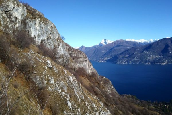
You are now on the Via dei Monti Lariani, a hiking trail of 125 km which starts atCernobbio and leads to the northern end of the lake connecting the small rural settlements scattered along the slopes on the west side of the lake. Just after you have left Breglia behind you, the trail is interrupted by a big land slide. In order to bypass the landslide, you are directed to a recently built cart-track that should have connected Breglia with Carcente but as for now it is not passable. After 200 meters you leave the track (sign) in order to reach the original trail again that leads through the chestnut woods down into the Val Greno. You cross the stream over a bridge where there is a little shrine dedicated to the Madonna of the valley. The path goes around the valley and reaches the picturesque village of Carcente. You can enjoy a nice view of the lake and on the Grigne (alt. 2410 m) that towers above the town Varenna on the other side of the lake.
At Carcente there is a small museum housed in a typical stone building of the village; it containstools and household furnishing featuring aspects of rural daily life. It is open by request tel. +39 3452461159.
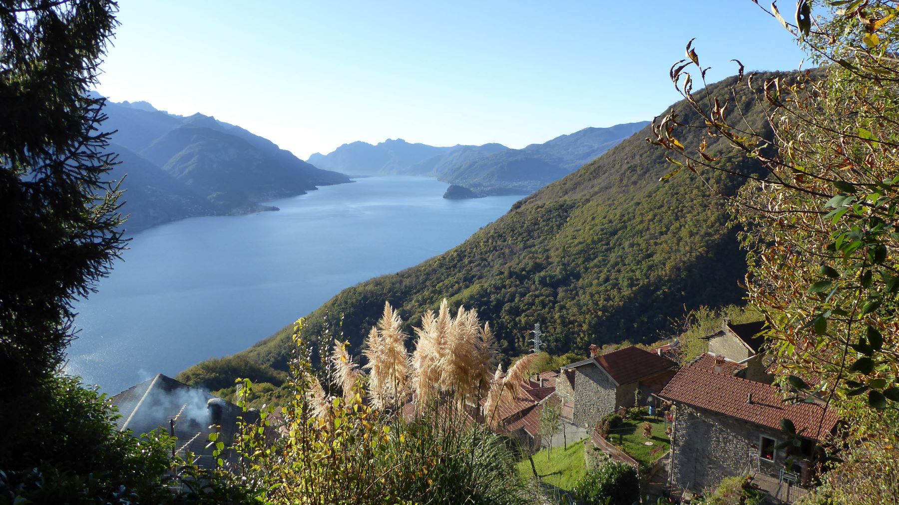
In the middle the village you pick up the cobble stone mule track to the left (via alla Mason dei Monti). It leads in a series of bends through a chestnut wood up to Monti di Carcente (alt. 847 m). Right at the beginning of this settlement you leave the “Via dei Monti Lariani” and go left following the sign for Alpe Rescanscia / S. Amate. From here follow the red / white / red signs that will lead you to Monti di Coslivetta (alt. 980 m). The woods now start to thin out and the chestnut trees give way to the birch trees. You reach the open pastures that surround the settlement of Cosliva (alt 1030 m) from where you have a wonderful view of the central part of lake Como; in the distance you can spot the village Breglia, starting point of our walk.
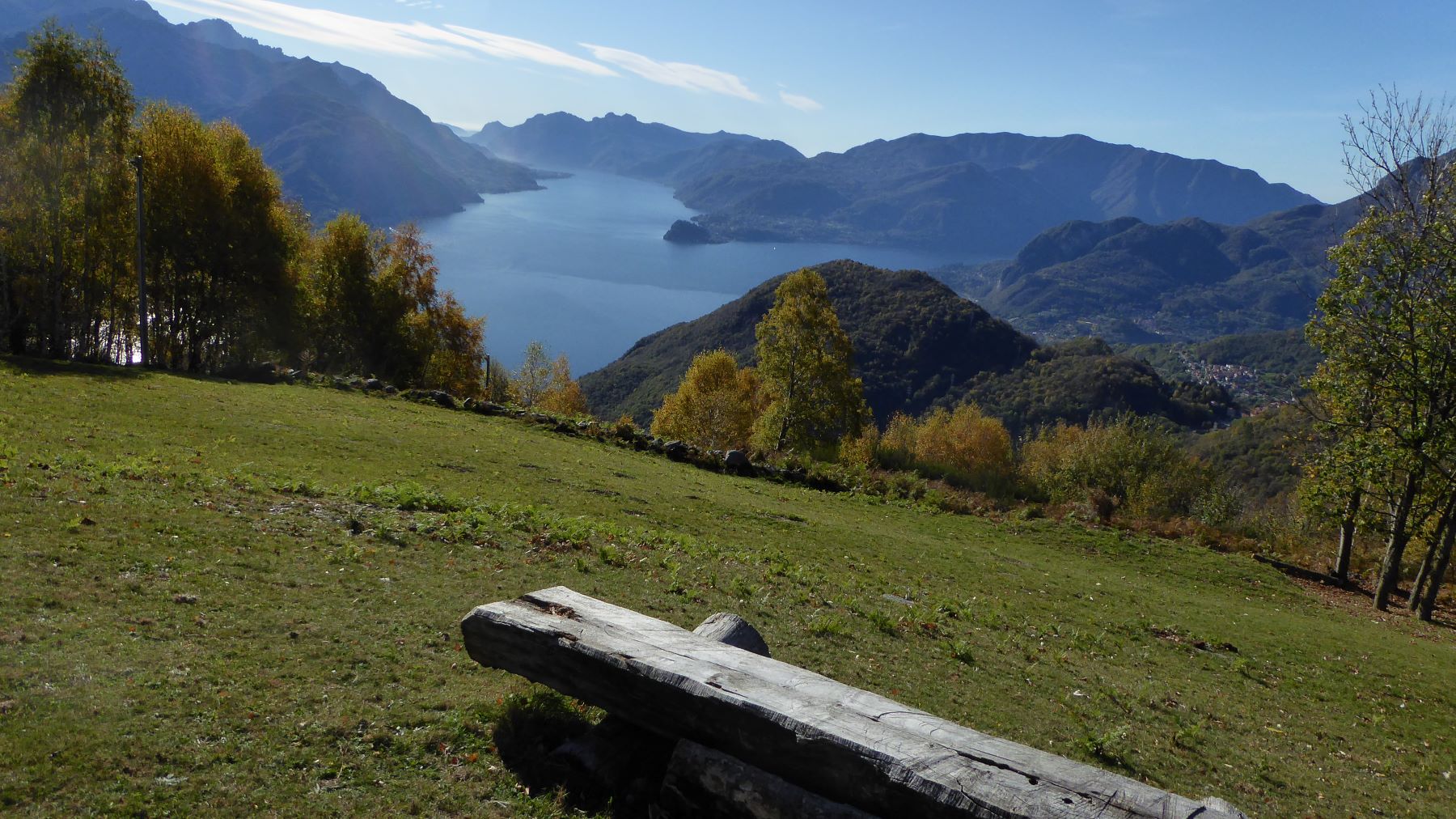
Then, past the settlement Motta, the trail leads steeply uphill amidst birch trees, ferns and broom to the vast pastures at the head of the Val Greno. Here stands the farm house Alpe Rescancia (alt. 1413 m). Head toward the farm with its typical local architecture. During the summer months cattle is brought up to graze and excellent cheese is made at the farm.
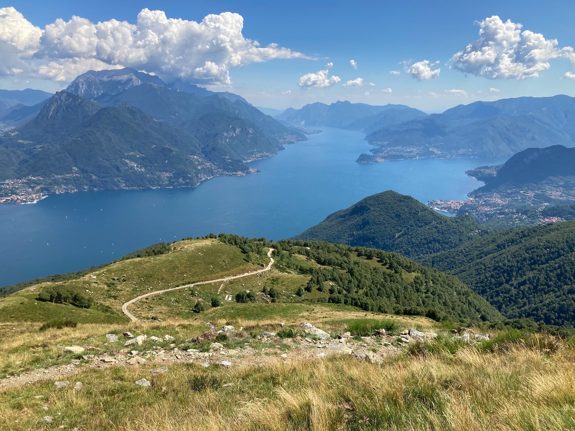
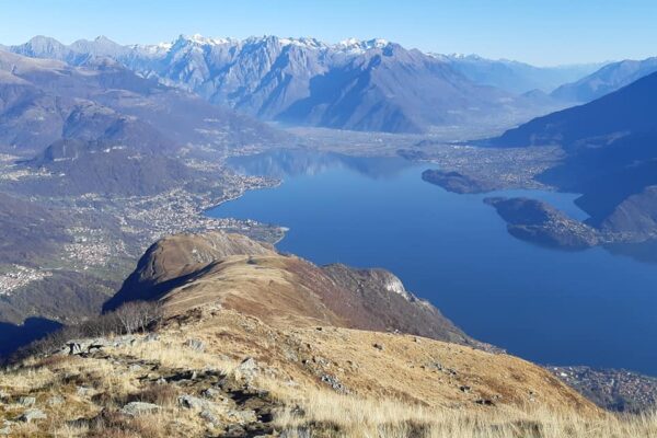
Pick up the trail that starts above the farmhouse in the direction of rifugio la Canua. After a brief ascending stretch the view opens onto the “Alto Lario”, the Northern end of the lake. You can distinguish the Bay of Piona with Monte Legnone (alt. 2609 m) towering above on the Eastern shore and towards the north the range of the Rhaetian Alps Retiche, the small lake of Mezzola and the mouth of the river Mera. The well-defined path leads along the slope of Monte Bregagno and in about 45 minutes you reach Rifugio la Canua.
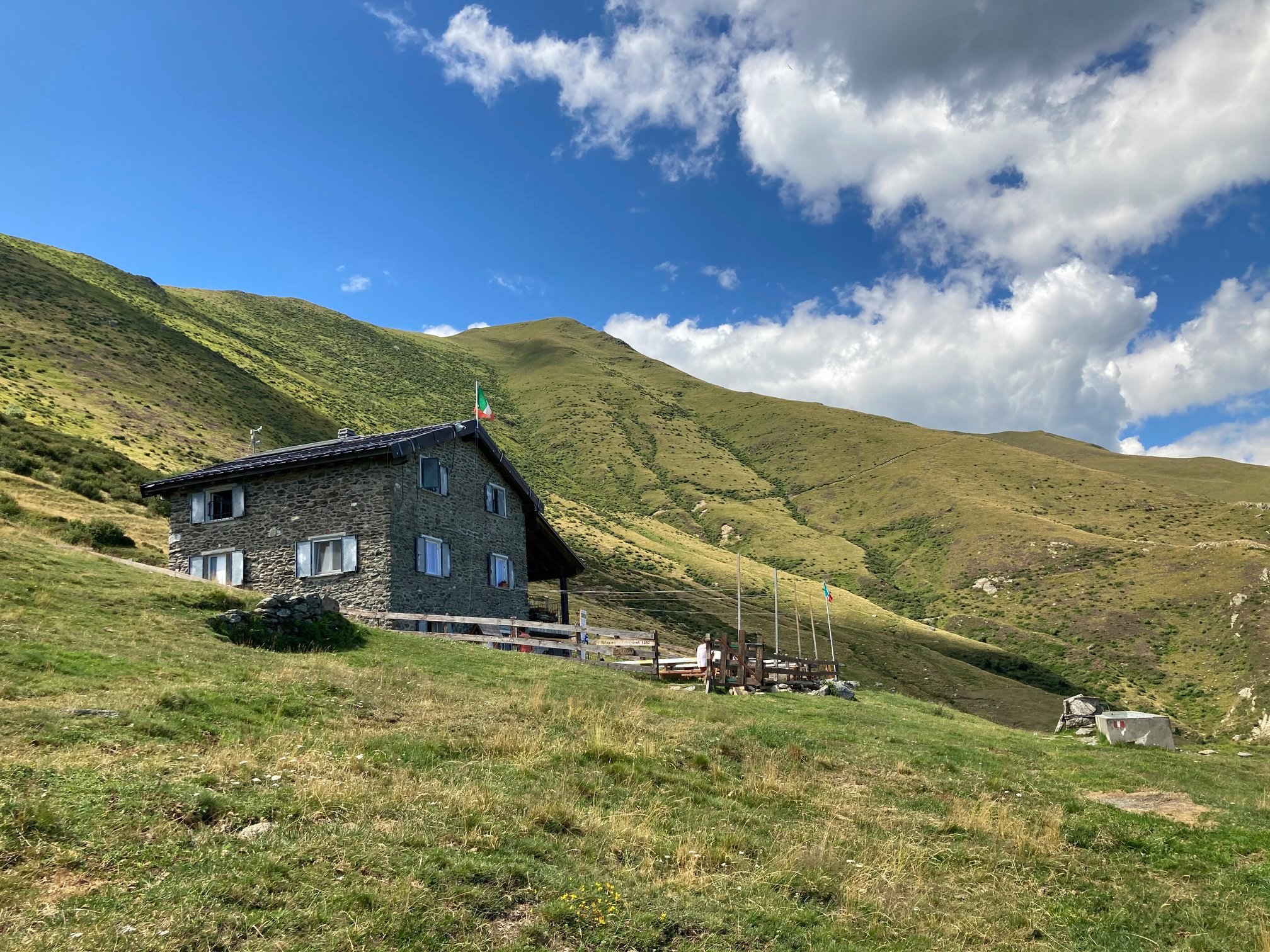
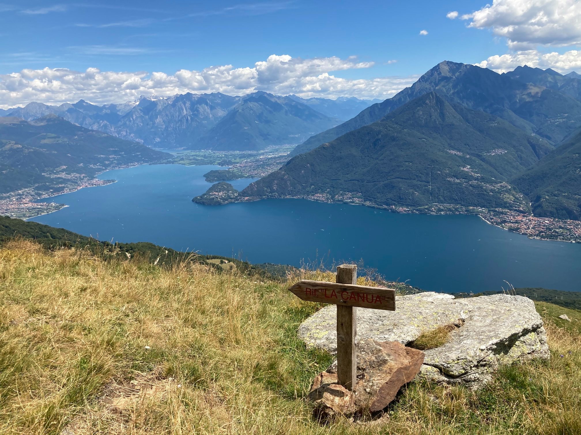
The rifugio is built on a natural terrace that offers a complete overview (Lecco branch) of Lake Como. In front of you towers Monte Legnone (alt. 2609 m) and lies the Valsassina. Rifugio la Canua is run by volunteers who are part of the charity group called Mato Grosso that operates mainly in South America. After a well deserve rest, for the return walk, you head in the direction of S. Amate. Pick up the not very well defined trail on the left side of the rifugio that leads steeply uphill in the middle of the pastures. After an ascent of about 15 minutes you reach a well-defined track that runs along the slope of Mt. Bregagno parallel to the path you have followed previously. After about a 30 minute walk the path leads to the other face of the mountain and below you can spot Alpe Rescanscia.
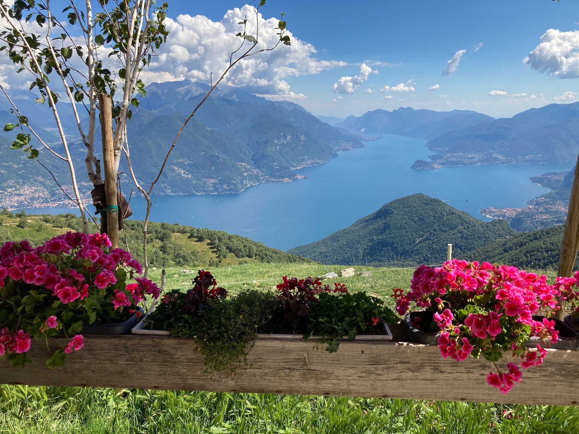
Cross the vast pastures in order to reach the ridge of Monte Bregagno. Head towards the cart track that leads up from the lake and connects Alpe Rescascia to the farm house Alpe Nesdale that you can see in the distance to the right. Cross the cart track walk down to the small church of S. Amate, patron saint of shepherds and cattle. From here you have a lovely view of lake Lugano, Mt. Grona (alt. 1736 m) and the Alpine mountain range.
From the church follow the indication for Breglia and follow the trail leads along the slope to a small saddle called “el Capel di Jiovan” in local dialect the “hat of Giovanni”. The view embraces the whole central lake area with the towns of Menaggio with Monte Crocione (alt. 1640 m), Bellagio with Monte San Primo (alt. 1682 m) and the Corni di Canzo (the two horns of Canzo) and Varenna dominated by the Grigne (alt. 2410 m). From the saddle the trail descends and crosses the trail that leads down from Rifugio Menaggio that you can make out to the right. Once at the parking at Monti di Breglia follow the series of shortcuts that will lead you back down to Breglia.
Directions & Parking
By public transport
From Menaggio to Breglia by bus line C13 – parking possibility at Breglia.
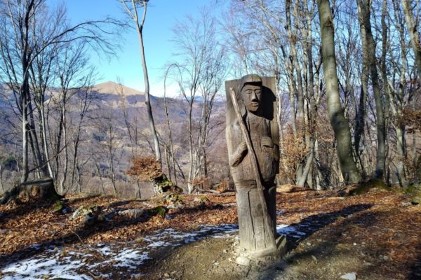
Gallery