[Skip to main content]
Via dei Monti Lariani

La Via dei Monti Lariani – section 4

Trekking routes

The old tracks which cross the mountains on the west side of the lake and were used – and some are still – by the local people to reach the Alpine pastures called “Monti”(Munt in the local dialect) have been transformed into
a series of paths following a marvellous itinerary called “LA VIA DEI MONTI LARIANI” (Lario being the ancient name of Lake Como).

It is a beautiful hiking trail of 125 km stretching out at an average height of 1.000 m, most “monti” being situated between 600 and 1.200 meters. 
The “Via dei Monti Lariani” is divided into 4 sections. The first one leads from Cernobbio to the Val d’Intelvi and is 28 km long, the second section leads from the Val d’Intelvi to the Val Menaggio, the third leads from the Val Menaggio to the Valle Albano and the fourth from the Val Albano to Sorico. The trail is well-marked with red-white-red signs in aluminium on tree trunks or walls, or painted on rocks numbered from 1 to 4 according to each section.

It’s impossible to walk the whole “Via” in 4 days, because the sections are too long and one has also to deal with the differences in altitude; 6 days would be the minimum amount of time needed staying overnight in the shelters or hotels located along the way.
Description

La Via dei Monti Lariani – section 4

First part: from Garzeno to Peglio

  • Duration: 8hrs
  • Length: km 24
  • Ascent: 300 m

This section, without much ascent, leads away from the lake along the valley of the river Liro and through the isolated valleys of S. Jorio and Dosso and passes by some interesting rural settlements.

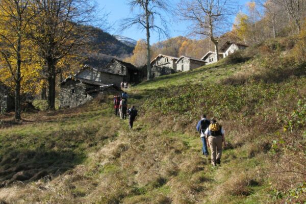
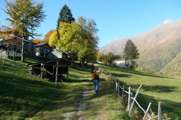
From the bus stop in the church square of Garzeno (650 m), follow a steep alley (above the fountain) marked with a 3 superimposed by a 4 that leads to the upper part of the town where it ends on to the paved road. Cross the road and proceed on a path that climbs up steeply through the woods. The path ends on to a field which you ascend keeping to the right. You then follow the trail that leads to Avolo (865 m), a picturesque rural settlement. Close to the houses (once the roofs were in straw) there is wide cart track which you follow to the left.

Just before reaching a small chapel, leave the cart track and pick up the trail leading up to the right to Sant’Anna (920 m 0.50 hrs). Just past the church of S. Anna you reach the paved road that leads up from Garzeno to rifugio Giovo. Follow it down to the right but at the following bend leave it and walk down the mule track to Cagnavo (885 m). At the next fork keep left, walk along the field and pick up the trail on the left that leads into the woods. The trail heads out of the Valle Albano towards the mountains dominating the lake. You end up on a road which you follow to the left. At the bend in the road at the settlement Cragno (850 m) pick up the cart track to the left which leaves the mountains facing the lake and leads into the valley.

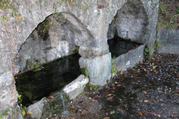
Keep on the even track but at the settlement Stabie’ leave it in order to descend to Ievia (810 m). An asphalt road leads from here to the byres of Nessa (866 m 1.30; 2.20 hrs). Leave the road here and turn down to the right and proceed on a path through the woods. You end on a cart track and at the next fork continue to the left in order to arrive at the clearing of L’Agnone (920 m 0.40 ; 3.00 hrs) where there is a fountain.

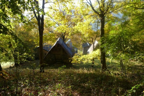
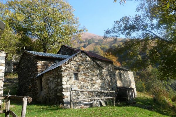
The “Via” then leads on amongst mountain slopes and mountain streams to the cattle byres of Badalucco. From here the trail descends into the S. Jorio valley. Beware of possible landslides in this area! You reach the head of the valley and cross the old Bodanghel bridge (985 m 0.50; 3.50 hrs). You cross a second stream and the path ascends to the settlement called Bodanghel with several groups of cattle byres out of stone with an interesting architectonical style. Near the last houses descend to the right and cross a field.

The path re-enters the woods and leads on to a cart track. Now turn right and cross a small bridge. After you have past a group of cattle byres you arrive at Boiena (960 m- picnic area). After a few hundred meters you reach a fork where you take left and follow the cart track that ascends from Ponte Maiavacca. When the cart track ends continue on a path leading through woods and fields entering the heart of the Val del Dosso. You meet a path signed with yellow paint which leads to Rifugio Vincino.

After you crossed a small bridge continue for about 500 meters till you reach a fork. At this point you leave the path leading to Rifugio Vincino (20 minutes from the “Via”) and follow the path to the right. At the next fork keep right in order to reach the farm houses of Piazza (998 m) From here the trail leads steeply downhill to the Vincino bridge (828 m 1.30 ; 5.20 hrs) over the river Liro. At the other side of the bridge, an easy trail leads to the fields of Pianezza (978 m).

The path continues through woods and among steep pastures reaches the farm buildings of Bolgiana. You end up on a cart track and follow it till you reach the road that leads up from Dosso del Liro in the area called Pian delle Castagne. Follow it down hill for about ten minutes, passing the deviation for the “Agriturismo La Fonte di Mariella” (100 metres) and then pick up the cobble stone mule track on the right that leads down to Dosso del Liro (625 m 1.30 ; 6.50 hrs) crossing the road several times. Here you find the bus stop for the line C18.

Follow the road downhill; leave it at the first bend and follow a path to the left leading into the Val Inferno. After passing the stream Ronzone the trail leads half way up the mountain slope past Arecc (702 m 0.40 ; 7.30 hrs) and gets down to the road Peglio-Livo (Agriturismo Zertin at 2 km) near the little church of the Madonna di Pian di Gorghiglio. This section finishes here. To continue turn left to Livo, in order to reach Peglio (650 m 1.30 ; 8.00 hrs) turn right.
right.

Second part: from Peglio to Sorico

  • Lenth: km 26
  • Duration: 8hrs30
  • Ascent: 626 m

This section leads through the remote valleys called Val di Livo, Val di San Vincenzo and Valle di Sorico. Magnificent
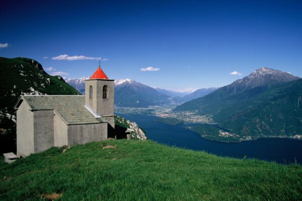
views of Lake Como and Lago di Mezzola on the final part of path 4.

From Peglio (650 m) follow the road in the direction of Livo passing the little church of la Madonna del Pian di Gorghiglio of the 17th century. (here you find the deviation for the agriturismo Zertin). You cross the plain delimited on the right by the hill called Sasso Pelo. Once at LIVO (657 m)  cross the village centre and then follow the road leading to Dangri past the cemetery where the antique San Giacomo church  of the 14th century stands. From here the cart track leads into the Livo valley down to the characteristic stone bridge called Ponte di Dangri (659 m 1.15 hrs) on the Livo stream.

After crossing the bridge turn right, (the path to the left leads to Capanna Como on lake Darengo). After a few meters ignore the track on the left leading into the Val di Bares but follow the Livo stream to the right on a not very well defined path. At a group of farm byres, it goes down to the streambed which you follow for a few hundred meters, and then you go up to left to the farmhouses of Barro (617 m 0.20 ; 1.20 hrs) an interesting rural settlement.

From here the path leads steeply downhill to the Bares stream. NB After a long period of rain it might be difficult and in some cases even impossible to cross the stream. After passing the Bares stream climb up a very steep path through the woods which reaches a group of farmsteads standing on a small saddle. From here the ascent continues to Puii (800 m) that is situated out of the woods surrounded by fields with a beautiful view of the Livo valley. At the fork, at the last building of Puii, take the ascending trail to the left. Then it goes up through the fields to Trobbio (950 m 1.40 ; 3.00 hrs).

From the fountain walk to the upper part of the settlement and from here to the right a path along the mountain slope leads out of the Livo Valley to Tabbiadello (980 m 0.30 ; 3.30 hrs) a wide mound that dominates the northern part of the lake with a marvellous view of the plain called Pian di Spagna, the mouths of both the Adda and the Mera river and the surrounding mountains. Near the fountain cross the cemented track that leads up from Vercana and continue
on the trail that leads to Roncai (1.000 m).

From here the trail turns into the San Vincenzo Valley and reaches Incisa (950 m 0.45 ; 4.15 hrs). At the last houses take the trail that descends to the right. The path leads quite level deep into the valley of San Vincenzo. At the head of the valley it goes down steeply through a birch wood to the stream. Cross the
bridge and after a few meters pick up the ascending trail to the left that climbs up the other side of the valley.

Out of the woods it goes halfway up the mountain slope to Montalto (1.030 m 0.45 ; 5.45 hrs) The path leads through the village and gets on to the asphalt road. Those who want to get to the Rifugio Alpino d’Alco follow the road down to the right for about 10 min.
The “Via” continues on the road up to the left. After 200 meters pick up the track on the left that after 100 meters ends on to a road which you follow to the right for about 500 meters. At the height of a small wooden shrine and an information panel indicating the names of the alpine farms of the area, leave the road and take to the left over the fields.

From here the path leads into the valley of Sorico, overlooked by Monte Berlinghera . After you have crossed two streams at the head of the valley, the path climbs up to the other side of the valley and then reaches the fields of Piazza Lunga (965 m) From here follow the cart track for about 800 m that ends out on the road that leads up from Gera Lario and in a short time leads to Fordeccia (1.094 m 1.30 ; 6.30 hrs).

Continue on the road and after 150 meters you reach a fork where you turn right (to the left you can reach after 200 m the Agriturismo Giacomino) You proceed on the cart track, with a marvellous view of Sasso Manduino, that leads to Colorina. Shortly after you reach Sass Olt (950 m) from where you have a superb view of Lago di Mezzola and the Val Chiavenna. Just before the two farmhouses you descend down to the right in order to pick up the path that leads to Baita Carla where you pick up the cart track on the left that leads to Monte Pradaioli.

The path goes down through thick chestnut woods to the clearing of Pozzi. You continue on the cart track that comes out on another cart track that you follow to the right in order to arrive at Peledo (817 m). The descent continues through the woods to Selve (409 m). From the fountain of the village the path leads down to the beautiful church of San Miro. From here it is only a brief stretch to Sorico (213 m 1.30; 8.00 hrs) where path 4 finishes.


Dopo 200 metri si imbocca la mulattiera sulla sinistra che sbuca su una carrareccia che si segue a destra. Dopo un breve tratto si arriva di nuovo sulla strada asfaltata e la si segue a destra. La strada scende a tornanti e dopo 500 metri, all’altezza di una piccola edicola votiva in legno e un panello informativo con i nominativi dei alpeggi della zona, la si lascia per prendere a sinistra sui prati. Da qui ci si inoltra, prima tra prati e poi immersi in un bosco di betulle, verso la profonda incisione della vallata di Sorico.

Dopo aver attraversato i due guadi in fondo al vallone, quello del Val Gigini e quello della Valle Scura,  il sentiero si dirige dapprima ripido e poi più in piano ai pascoli di Piazza Lunga (965 m).  La località offre una bellissima vista sulla parte settentrionale del lago e sulla mole del Monte Legnone (2.267 m) dall’altra parte del lago. Volgendo lo sguardo indietro, si intravede la cima rocciosa del Sasso Canale (2.411 m). Da Piazza Lunga si procede sulla carrareccia che sbuca sulla strada asfaltata che sale da Gera Lario e in breve porta a Fordeccia (1.094 m ore 1.40; 6.40)

Si prosegue sulla strada asfaltata e giunti ad un bivio si prosegue a destra (a sinistra si può raggiungere dopo 200 metri l’agriturismo Giacomino). Dopo alcuni tornanti in discesa, si prosegue sulla carrareccia che, guardando la poderosa costiera del Sasso Manduino, porta al piccolo nucleo di Colorina. Si prosegue lungo la carrareccia per arrivare alla località Sass Olt (950 m). Si aggira le due baite e prima di continuare, si risale il belvedere da cui si gode una stupenda vista sul lago di Mezzola e la Val Chiavenna.

Si continua su un sentierino in mezzo alle felci che porta a Baita Gaia, dove si imbocca la carrareccia sulla sinistra. Al prossimo bivio si prende in salita a destra e, attraverso un fitto castagneto, si raggiunge la radura di Pozzi (844 m), dove si può osservare una particolare fontana ad arco per l’abbeveraggio del bestiame. Si continua sulla carrareccia che sbuca in altra carrareccia che si segue a destra per arrivare a Peledo (817 m). Prestando molto attenzione alla segnaletica ai vari bivi, la discesa continua in mezzo al bosco fino al paesino Selve (409 m ore 1,20; 8,00)

Raggiunta la fontana del paesino si riprende la discesa sempre nel bosco su una vecchia mulattiera disconnessa per raggiungere infine la bellissima chiesetta di San Miro: al suo interno sono conservate le spoglie del venerato eremita, preziosi affreschi del XVI sec. di De Magistris e una tela del Fiammenghino.  Una scalinata lastricata scende a Sorico (213 m ore 030; 8,30), meta di questa tappa e punto conclusivo della Via dei Monti Lariani.

available maps:

  • Kompass 91 – Lago di Como/Lugano – and 92 – Chiavenna/Val Bregaglia – o 676 scale 1:50.000
  • La Carta dei Sentieri dell’Alto Lago della Comunità Montano Valli del Lario e del Ceresio scale 1:35.000


Lodging along the trail:

  • Garzeno
    two hotels and some B&Bs
  • Rifugio Vincino                                                   
    5.00hrs from Garzeno refuge without managment 0,20h from the trek
    keys and reservatione town hall at  di Gravedona ed Uniti   tel. 0344 81265
  • Agriturismo la Fonte di Mariella                                
    6.40h from Garzeno at Monte Carsano
    tel. 339 7703968 – www.agriturismomariella.com
  • Trattoria Falco                                                   
    at Peglio
    tel. 0344 85444
  • Agriturismo Zertin                                           
    2 km above Peglio
    tel. 338 1759775 –   www.agriturismozertin.com
  • Rifugio Alpino Dalco                                            
    200 metri from the trek at Montalto”
    tel. rifugio 0344 84572 – tel. manager 0344 84387 –
    rifugio.dalco@libero.it
  • Baita del Vikingo
    6.30h from Peglio at Fordeccia
    tel. 0344 536048 – tel. manager 331 5603746
    baitadalvikingo@gmail.com
  • Agriturismo Giacomino                                     
    6.30h from Peglio at Fordeccia
    tel/fax 0344 84710 – cell. 333 1313313 –               info@agriturismogiacomino.it
  • Sorico
    various hotels and B&Bs

Directions & Parking

Map directions →

By public transport
  • Garzeno can be reached from Dongo  by bus line  C17 of the Asf bus company.
  • Dosso del Liro, Peglio and  Livo can be reached from Dongo with bus line C18 of the ASF bus company
  • Sorico is connected with bus line C10 of the ASF bus company

Gallery