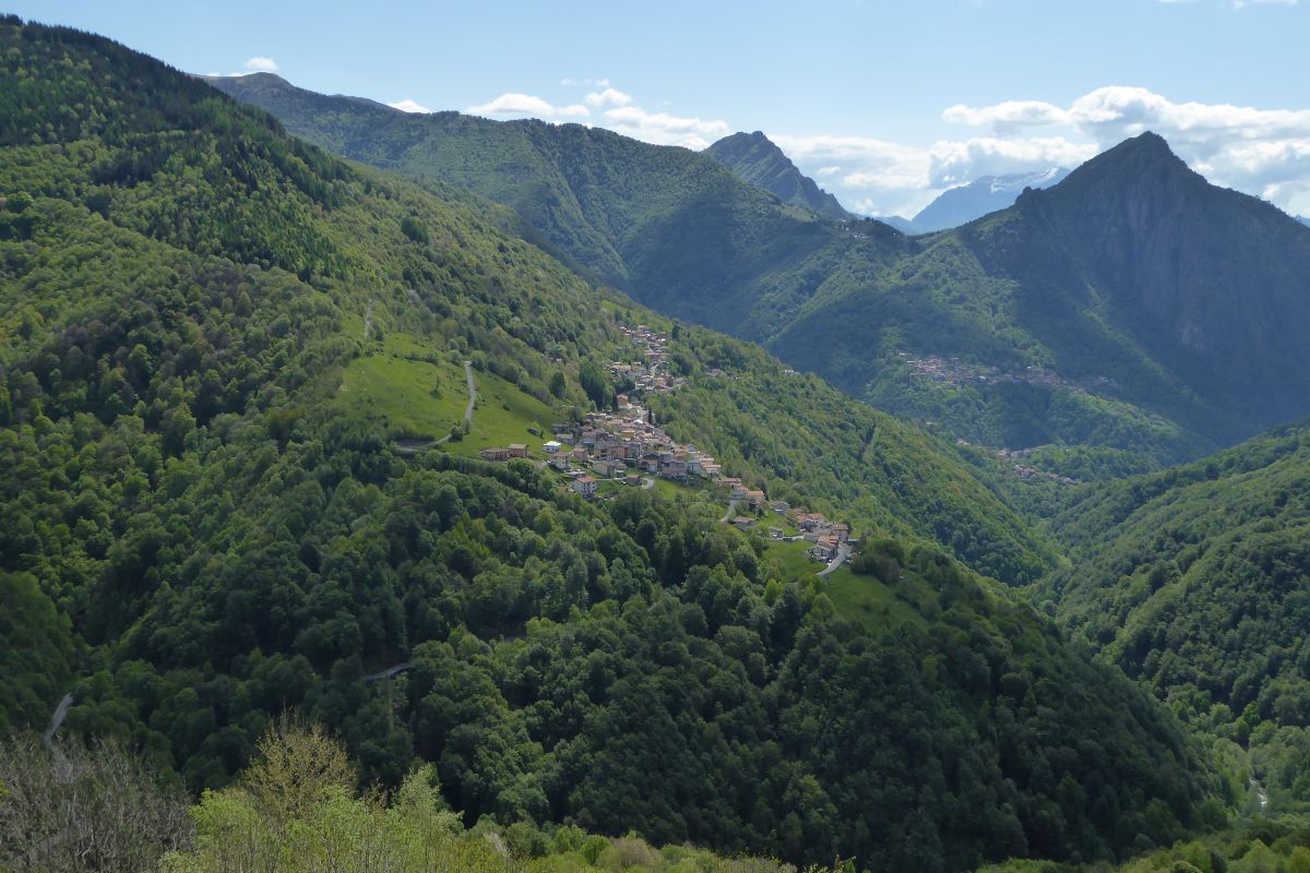
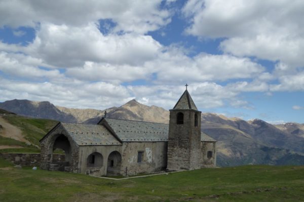
This itinerary leads through the remote Val Cavargna, a valley that is geographically located between the alpine and pre-alpine belts. It offers wild and uncontaminated landscapes. From Carlazzo (alt. 463 m) you go up the asphalt road with little traffic to San Nazzaro, a small village clinging to the southern slopes of Pizzo di Gino (2245 m). From there, still on asphalt, you cycle up to the pinewood of Tecchio 1280 m. From here the mountain road winds its way up to Rifugio Croce di Campo (alt. 1741 m) where you can enjoy a wonderful view. Go down again on the same road to San Bartolomeo from where you follow a stretch of the Via del Ferro, a historical route that connected the Cavargna and Albano valleys and their mining and iron sites. You cross the bucolic village Sora to descend along the cobble stone track to Ponte Dovia. In this location, in the first decade of the nineteenth century, there was a small nucleus, that housed the Austro-Hungarian customs (now a home), a smelting furnace, a forge with a mallet and a lime pit. At Ponte Dovia the two rivers Cuccio di Cavargna and the Cuccio di San Bartolomeo meet. From Ponte Dovia, you return on the cobblestone track, back to Carlazzo.
Description
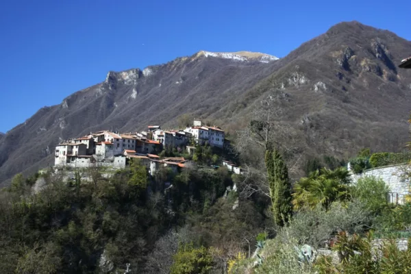
From Carlazzo (alt. 463 m), take the road in the direction of Val Cavargna, pass by Cusino (alt. 786 m), and after a short descent, start climbing again to S. Bartolomeo (alt.843 m), pass the village and continue towards S. Nazzaro. Once in S. Nazzaro (alt. 953), at the end of the village take the road to the right that goes up towards Regolè, rifugio Croce di Campo. When you reach the small church of San Rocco turn right again and follow the road that climbs up in the hairpin bends to the pinewood of Tecchio 1280 m. Take the road on the left to the Croce di Campo refuge, that you can already see.. The road climbs in hairpin bends, with a steep and demanding slope.
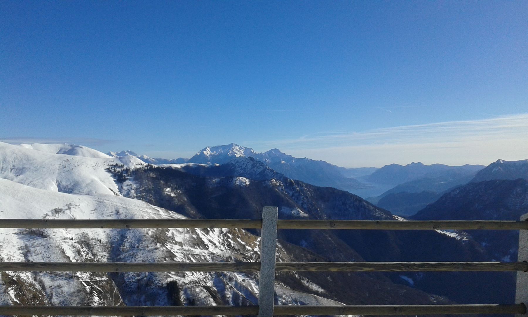
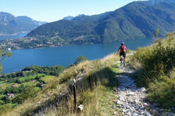
From rifugio Croce di Campo (alt. 1741 m), you can enjoy a magnificent view. On the left you can see a strip of Lake Como where the Grigne towers (alt. 2410 m), as a frontal mirror you can see Monte Crocione (alt. 1640 m), Monte Galbiga (alt. 1698 m) and Monte Sighignola and on the right Cima Fiorina and Monte Garzirola (alt 2103 m).
Return on the same road until you reach San Bartolomeo. Near the pharmacy, turn right into via Fontana. Near the church of San Bartolomeo, you take on the left via Sora. It descends in hairpin bends to the village of Sora (alt. 749 m). You cross the historical center to follow the cobblestone track that goes down to Ponte Dovia at the bottom of the valley (alt. 582 m). From here ascend the track to a small chapel, then go down to Maggione, a hamlet of Carlazzo. Follow via Antonio to return to Carlazzo.
Directions & Parking
Parking
Approach by car: from Menaggio follow the highway 340 towards Lugano for 8 km. At the roundabout, turn right in the direction of Carlazzo. At Carlazzo you park your car near the sports center.
Gallery