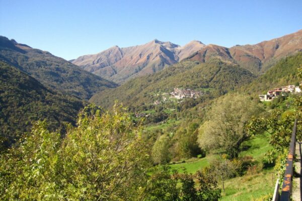
The Val Cavargna and the Val Rezzo are two beautiful valleys surrounded by the Alpi Lepontine with peaks more than 2000 m high. You can enjoy magnificent views and beautiful mountain scenery by following this route. The town Cavargna (alt. 1071 m) is the highest municipality in the province of Como.
Description
Route: Menaggio – Pian di Porlezza – Carlazzo – Cusino – San Bartolomeo – San Nazzaro Cavargna – Cavargna – Passo della Cava – Buggiolo – Corrido – Porlezza – Menaggio 53 km
From Menaggio you follow the road towards Lugano, which wind its way up the side of the hill to the village Croce at the beginning of the Val Menaggio. On our left sours Monte Crocione (1670 meters) and on the right Monte Grona (1736 m). After 6 km, at the roundabout, turn right and take the road SP10 in the direction of Carlazzo. The road offers a wonderful view of the Val Menaggio and the little lake Lago di Piano, a natural oasis. Once at Carlazo, an ancient fortified village, turn right in the direction of Cusino / Cavargna.
The Val Cavargna until a few years ago was an isolated world in the heart of the Lepontine Alps. While showing the signs of recent modernization (the provincial road was only built in 1953), the villages still retain in part their original rustic architecture. In the past, the people of the valley led a hard life; smuggling and migration was a reality of the local area. In the last 50 years, the valley’s economy has profoundly changed, as many inhabitants have abandoned agricultural and pastoral work to go to work in Switzerland.
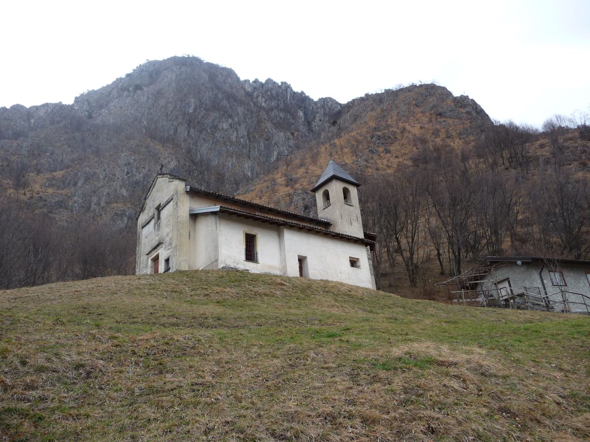
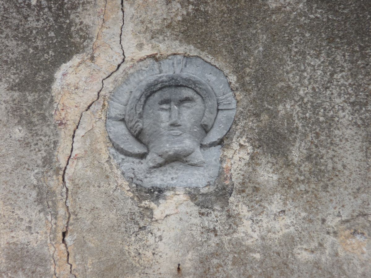
The road winds its way up to Cusino (800 m) where we recommend a visit of the antique oratory of S. Ambrogio. The small church stands in an elevated position before reaching the actual town. About 500 meters after the sign indicating the beginning of the municipality of Cusino, you park the car in the small open space in front of the bus stop. From here you walk up the slope (50 m) to the ancient oratory of S. Ambrogio. The oratory is of early medieval origin. A stone high relief with the face of Christ, datable between the 11th and 12th centuries, is set on its facade.
At Cusino (800 m) the parish church of S. Giovanni Battista is worth a visit. The church, a single-nave building with side chapels, dates back to 1300. It houses interesting frescoes. In the 17th century the church was completely renovated preserving though the massive late Romanesque bell tower. On the tower there was a fresco depicting St. Christopher with the Child on his shoulder which has been recently placed inside the church together with other paintings of the fourteenth and sixteenth century.
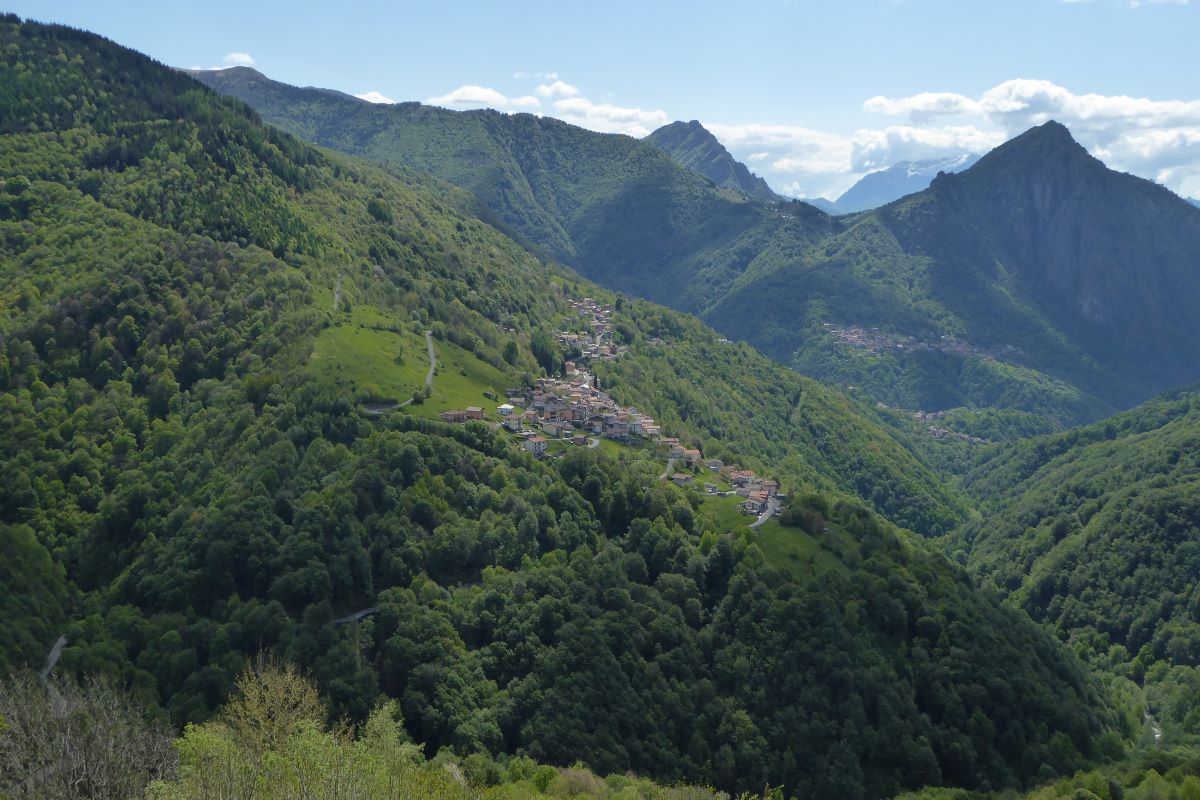
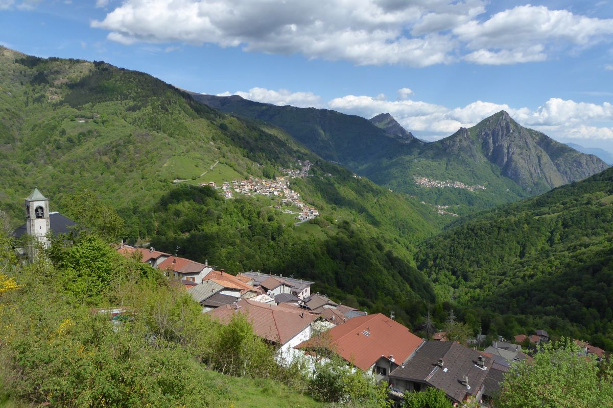
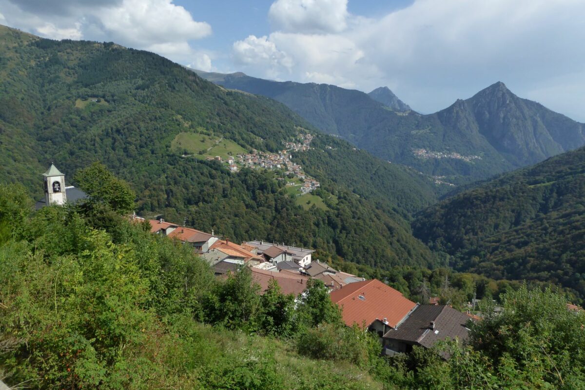
The road then leads through the quite large village of San Bartolomeo followed by the village of San Nazzaro which is clustered to the south slope of Pizzo di Gino (2245 m). The view sweeps across Monte Garzirola with the oratory of San Lucio on its crest and the village of Cavargna clinging on its slopes.
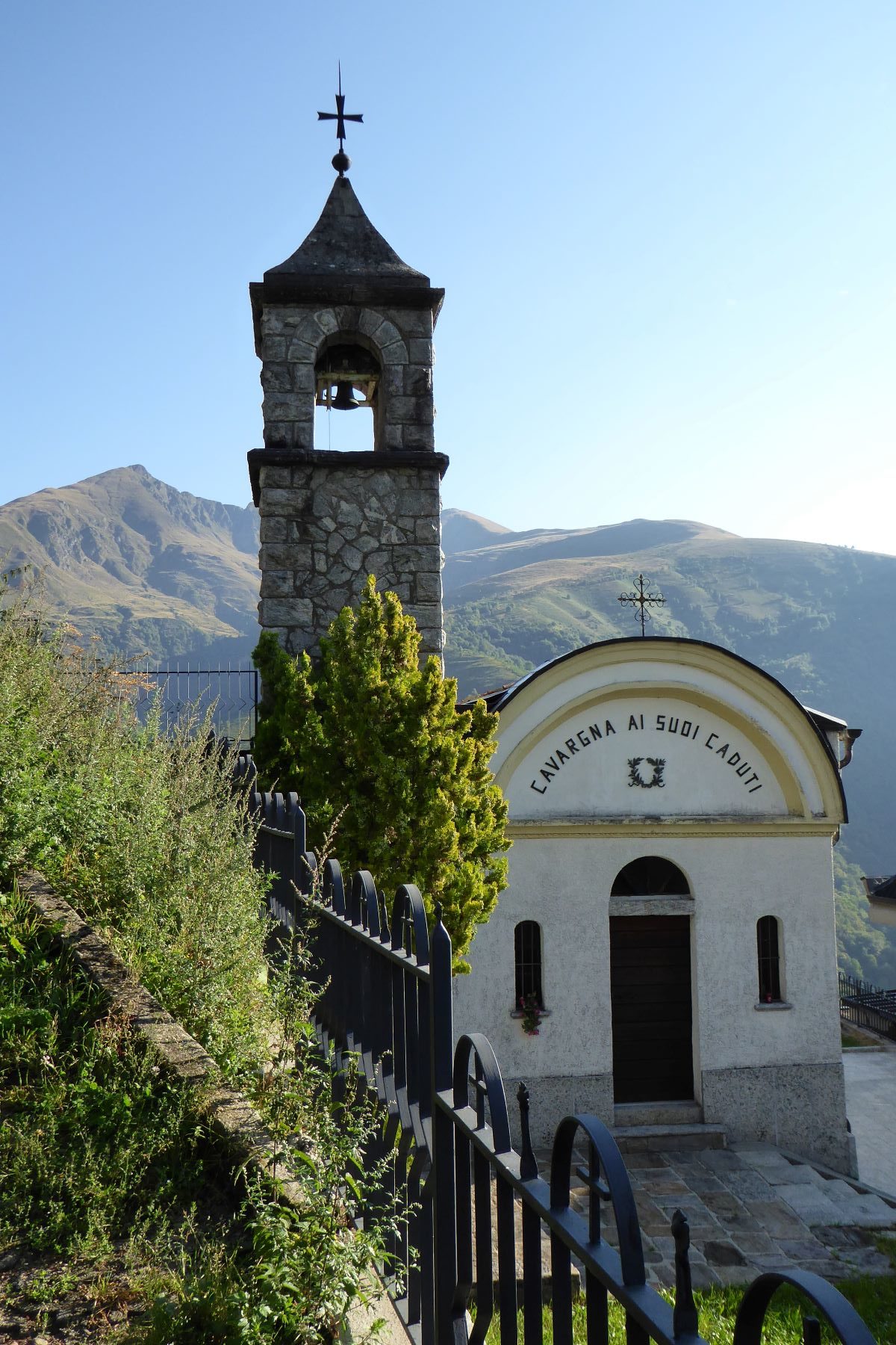
You cross the bridge over the Cuccio stream and just pasts the settlement Segalé you pass the intersection to Val Rezzo. Before taking this road (open from April to the end of October) you reach the village of Cavargna at 1071 m. It is the highest town in the Province of Como. Park your car in front of the town hall. From here the splendid view embraces the whole valley and the summit of Pizzo di Gino 2245 m on the left.
In front of the parish church of Cavargna there is the interesting museum called “Museo della Valle”. The Museum illustrates the local history, traditions and customs focusing on the smuggling phenomenon and the old mining and siderurgical activities. The figures of the magnan, the blacksmith, the alpine farmers, the woodcutter, the carpenter and the smuggler, as well as various aspects of daily existence. It is open from Easter to November 1st Saturday and Sunday from 2.00 pm to 5.00 pm – on other days on request tel. +39 0344 63162.
Turn back to the intersection for Valrezzo and turn right. The road leads in hairpin bends up the wooded ridge that divides Val Cavargna from Val Rezzo. You reach the pass called Passo della Cava and at the beginning of the descent you can see the ruined barracks of the “Guardia di Finanza” on the left.
The Spalloni
The military guarded the border, barred by a long wire fencing called “ramina”, to stop any smuggling actions. Goods such as sigarettes, salt and coffee were transported in special rugsacks called “bricolla” by the local smugglers the so-called “spalloni” (large shoulders) from Switzerland into Italy. They moved along the narrow steep mountain trails which they knew by heart using a long stick to secure their passage. Their boots were covered with rags of jute to prevent them from making any noise. Their adventurous stories are often told around the fire places in winter.
San Lucio
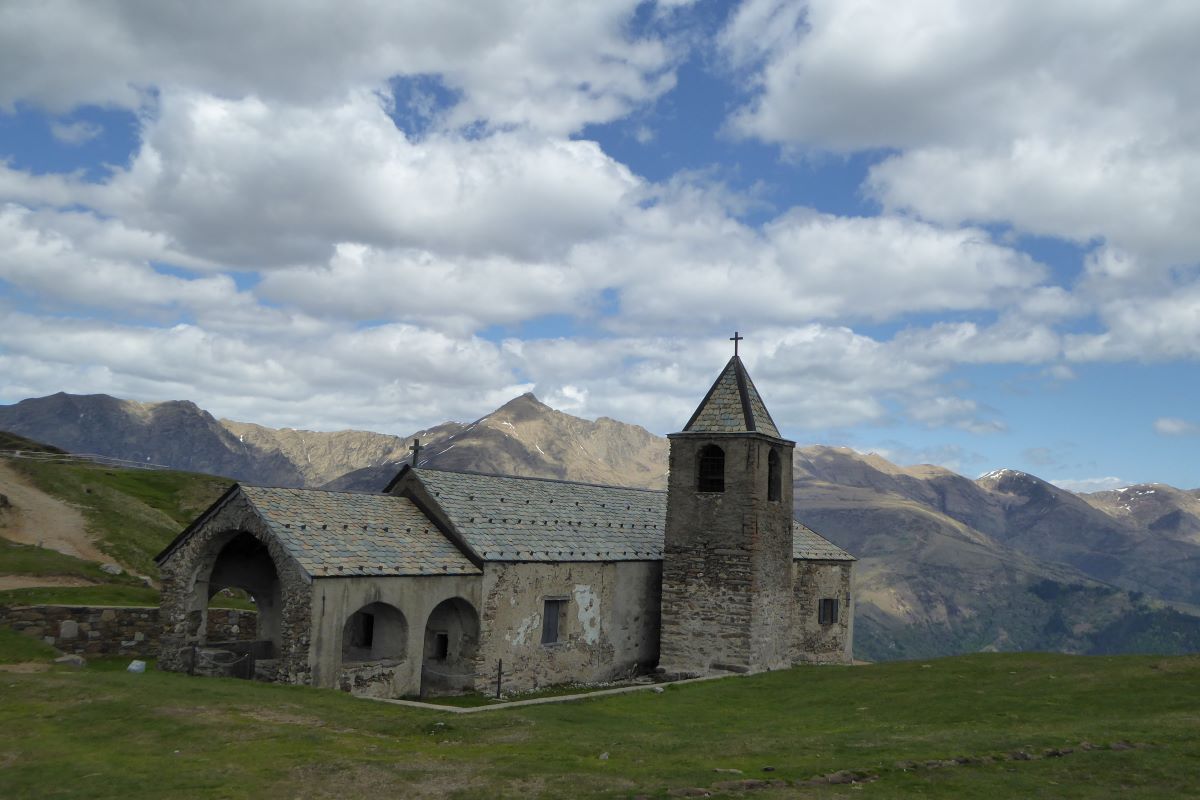
From the ruines of the barracas at loc. Dasio you can reach in 1.20 hrs. on foot, the famous church San Lucio (1.541 m) located on the Swiss-Italian border. It dates back to the 15th century and has always been a cultural and devotional point of reference for Swiss and Italian people. Inside the building, there are paintings from the 15th up to the 17th century and a 15th century wooden statue which represents Saint Lucio, patron of shepherds and cheesemakers. He is celebrated on the 12th of July and 16th of August with a popular festival attracting a lot of people from the surrounding Italian and Swiss valleys. Next to the church, you can find Rifugio San Lucio, a former Customs police barracks built in 1903. When the economic conditions improved in the 1960’s, and the smuggling phenomenon took back, the barracks was closed and left abandoned until it was turned into a Rifugio in 1999.
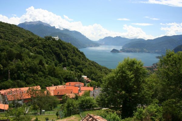
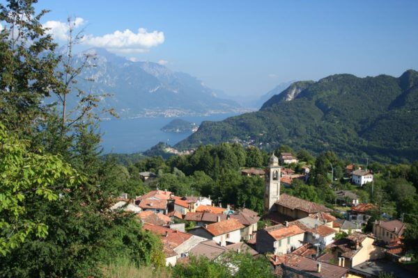
Continue the descent into the Val Rezzo. Just past the village Buggiolo the narrow windy road leads down to Corrido, a small village built on a rock plateau. Before the descent to Porlezza we recommend to drive to the church of the Saints Materno and Martino. At the crossroads in front of the town hall, turn left in order to reach the church. From the church yard you can enjoy a spectacular view of the plain of Porlezza, Lake Lugano and the Menaggio Valley.
Turn back to the Town hall, and turn left in the direction of Porlezza. It is a Small tourist resort on Lake Lugano. From 1885 to 1939 the village was the end of the Porlezza – Menaggio Railway Line and served the many international tourists who arrived from Lugano by steamboat. The former railway track has been converted into a pedestrian and cycle route. Before returning back to Menaggio we recomend a stroll through the center of Porlezza.
Directions & Parking
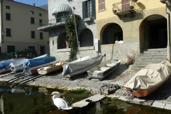
Gallery